| Directions
Locate Natural Bridge on NY 3, between Carthage and Harrisville.
Going east on Route 3, the first right will be named the
old State Road. The first right off this is the Henry
Road. This will end at a "T" at the McCoy
Road. Take a right and just past the first home on
the right is the trail head.
|
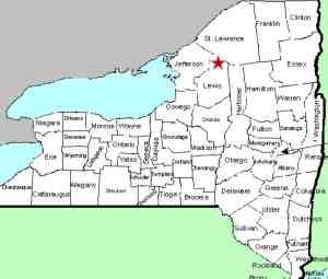
| County: |
Lewis |
| Town: |
Diana |
| USGS Map: |
Natural Bridge |
| Waterway: |
Blanchard Creek |
| Latitude: |
N 44o 04'
00" |
| Longitude: |
W 75o 26'
09" |
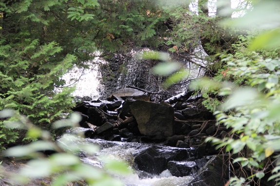
| Drop: |
~15' |
| Type: |
Ribbon cascade/slide |
| Region: |
Near Natural Bridge |
| Parking: |
Roadside |
| Trail type: |
Dirt, rock |
| Length of hike: |
0.1 mile |
| Difficulty: |
Easy |
| Accessibility: |
Private, posted |
| Name: |
Unnamed |
|
There are a number of items we need to clarify about this
location. On our only trip there, we were with a DEC official who noted that
the posting was relatively new. It wasn't posted when he was
there a couple of years before. We called the number on the
sign and explained what we were doing. The lady on the other
end of the line very graciously granted us permission to access
it. The bad news is that after getting back from this trip,
we discovered that our pictures left a bit to be desired.
We apologize for that.
Next, at that time, the home here had a for sale sign so it
is not certain if the next owner will also post it, or allow
access as the previous owner did.
Finally, we originally had this listed as Blanchard
Creek Falls. We have subsequently found out that there are
two Blanchard Creeks in Lewis County. This one originates
just west of the West Branch of the Oswegatchie River not far at
all from where the other one terminates. They are,
however, two separate waterways. To clarify, these falls are technically unnamed.
Because of the discovery of the second Blanchard Creek, we are
now calling these Knickerdocker
Falls. That is not a mis-spelling! At one point, this
property was owned by a Dr. Knickerdocker and the locals called
them this.
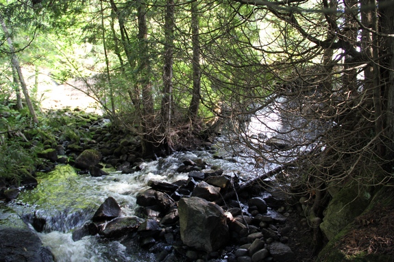
The creek is not far off the road. Just upstream
from here is the Blanchard Pond. There appears to be a man-made
dam at the outlet which forms part of this waterfall. It has
been there for decades. One could assume that there might
have been a mill there at one point in time but we don't know that
for certain.
The Blanchard Creek joins the Indian River a short distance downstream
of this location, just below the hamlet of Natural Bridge.
The Indian continues its flow downstream through Black Lake.
Then it joins the Oswegatchie River which flows to the St. Lawrence
River in Ogdensburg.
Last update: June 28, 2017
|