| Directions
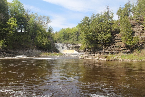
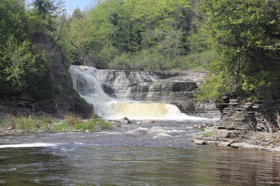
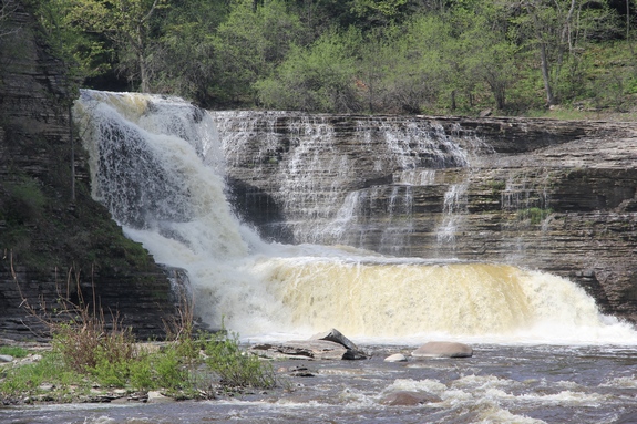
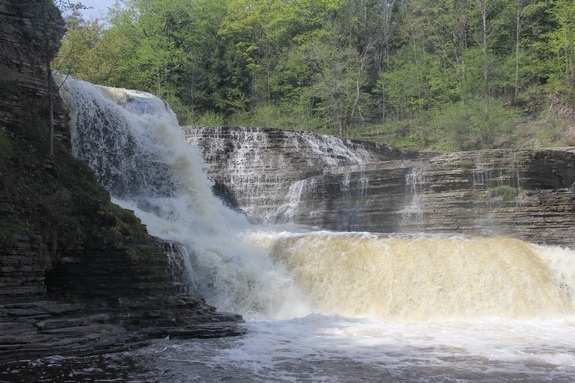
This waterfall, located off the Roberts Road in the
community of Copenhagen, is now posted by the landowners
and owners of the hydro facility.
|
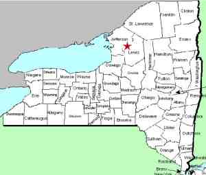
| County: |
Lewis |
| Town: |
Denmark |
| USGS Map: |
Copenhagen |
| Waterway: |
Deer River |
| Latitude: |
N 43o 55' 01" |
| Longitude: |
W 75o 37' 59" |
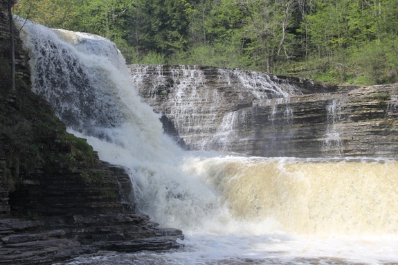
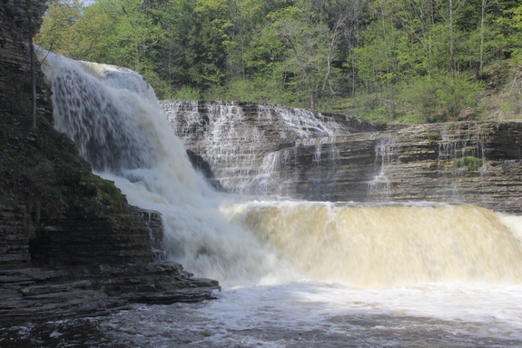
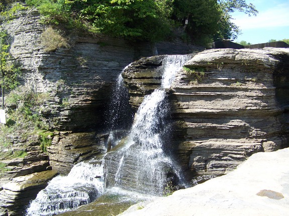
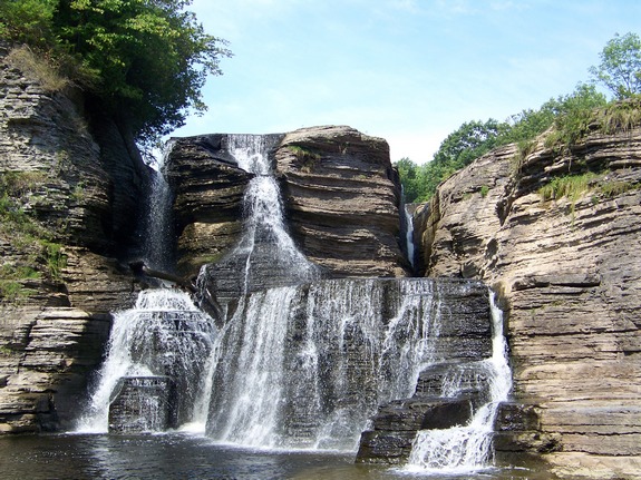
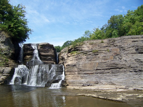
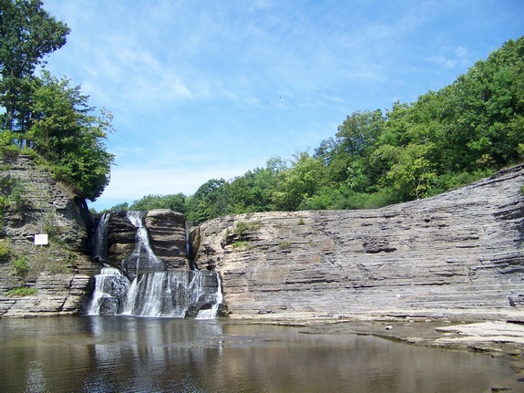
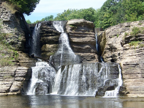
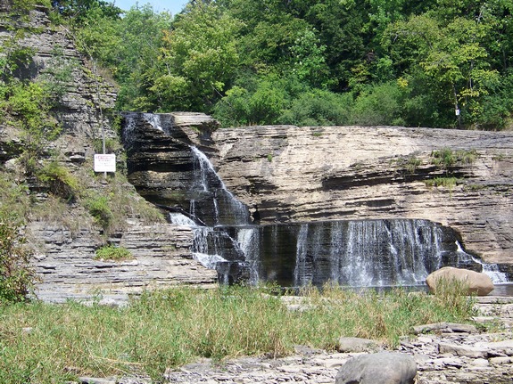
| Drop: |
40' |
| Type: |
Classical cascade |
| Region: |
Northeast of Copenhagen |
| Parking: |
Unpaved lot |
| Trail type: |
Dirt |
| Length of hike: |
0.6 mile |
| Difficulty: |
Easy |
| Accessibility: |
Private |
| Name: |
Official |
|
There have been some new developements regarding the region
around King Falls. The property adjacent to the river on
the Roberts Road access side, including the road leading into
the falls and the property on both sides of that road is
privately owned by a local farming family. Recently there
have been a number of issues including vandalism at the hydro
site, garbage left at the waterfall location, two locks cut off
the gate and the theft of a portion of the gate holding the
lock. Because of these and other recent problems, the
landownwers and the hydro company that now owns the plant have
posted the property.
The stories about King Falls have been circulating for
some time. The tales are almost legendary. It has
been a popular hiking, picnic and party area for decades.
It is our belief that a disrespectful public, probably local to
that area and probably a younger group, are responsible for this
negative activity. We would like to believe that people
reading this website, waterfall hikers and lovers, are not in
the demographic that would abuse such a facility. Comments
made on several waterfall blogs and Facebook pages support the
fact that the waterfall community does not condone and in fact,
condemns this behavior.
However, as the saying goes, it is what it is. The
actions of a few will mean that the many will pay.
Unfortunately, these new restrictions will probably not stop the
violators. Please honor the landowners' requests and
right. The property is now posted.
As for the waterfall, it gets its name from the fact that it looks somewhat
like a king's throne. This is more evident during lower water
flow.
The Deer River flows to the Black River which empties into Lake
Ontario at the Black River Bay, just southwest of the village of
Dexter.
Last update: June 7, 2016
|