| Directions
We are researching specific information on getting to
this location.
|
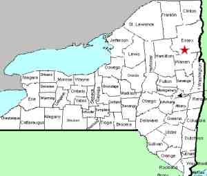
| County: |
Essex |
| Town: |
Minerva |
| USGS Map: |
Schroon Lake |
| Waterway: |
Falls Brook |
| Latitude: |
N 43o 48' 41" |
| Longitude: |
W 73o 57' 52" |
| Drop: |
NA |
| Type: |
NA |
| Region: |
West of Schroon Lake |
| Parking: |
NA |
| Trail type: |
NA |
| Length of hike: |
NA |
| Difficulty: |
NA |
| Accessibility: |
NA |
| Name: |
Unnamed |
|
We have found a number of references to several
small waterfalls on this small waterway just northeast of the community
of Minerva. Unfortunately, none of the references are very
detailed about the number of waterfalls or specific details on accessing
them. Contour lines on the topographical maps of the area
would support the fact that the creek drops significantly over a
relatively short span. We are continuing to research this.
If anyone has any pictures or information on this waterfall,
we would be very interested in
hearing from you.
Falls Brook flows into Minerva Stream, which empties into Trout
Brook. Trout Brook flows into the Schroon River just south
of Pottersville and Schroon Lake. This then empties into the
Hudson River just south of Warrensburg. The Hudson flows into
the Atlantic ocean in New York City.
Last update: September 1, 2015
|


