| Directions
From I-87 exit 29, proceed west on the Blue Ridge Road.
In about 5.3 miles, you will cross The Branch (a creek)
and just beyond this on the left, there is a trailhead for
the Hoffman Notch Trail.
|
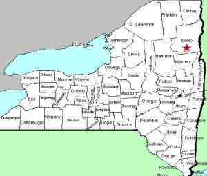
| County: |
Essex |
| Town: |
North Hudson |
| USGS Map: |
Blue Ridge |
| Waterway: |
Hoffman Notch Brook |
| Latitude: |
N 43° 56' 19" |
| Longitude: |
W 73° 51' 7" |
| Drop: |
NA |
| Type: |
Multiple falls |
| Region: |
West of North Hudson |
| Parking: |
Roadside shoulder |
| Trail type: |
Dirt |
| Length of hike: |
NA |
| Difficulty: |
NA |
| Accessibility: |
Public |
| Name: |
Common |
|
We have found references to a number of small waterfalls
on this brook. Although we have not yet been there, topo maps
do show a trail through the area. We are continuing to research
this.
If anyone has any pictures or information on this waterfall,
we would be very interested in
hearing from you.
Hoffman Notch Brook flows into the Branch, which empties into
the Schroon River just southwest of the hamlet of North Hudson.
The Schroon flows through Schroon Lake and then continues its journey
to the Hudson River just outside of the village of Warrensburg.
The Hudson flows into the Atlantic ocean in New York City.
Last update: october 6, 2015
|


