| Directions
At the intersection of NY 5 and NY 50 in Scotia, drive
north on NY 50 for 3.5 miles. Take a right on the Glenridge
Road and continue for another 1.3 miles. At that point,
turn left on Maple Avenue/CR 29 and proceed for 0.4 miles.
The parking area for the Indian Kill Nature Preserve will
be on your left.
|
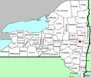
| County: |
Schenectady |
| Town: |
Glenville |
| USGS Map: |
Schenectady |
| Waterway: |
Indian Kill |
| Latitude: |
N 42° 52' 31" |
| Longitude: |
W 73° 55' 1" |
| Drop: |
8' |
| Type: |
Multiple falls |
| Region: |
Northeast of Scotia |
| Parking: |
Unpaved lot |
| Trail type: |
Dirt |
| Length of hike: |
3/4 mile, one-way |
| Difficulty: |
Easy to moderate |
| Accessibility: |
Public |
| Name: |
Common |
|
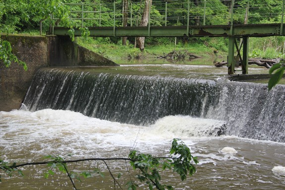
There are two waterfalls and a small dam in the
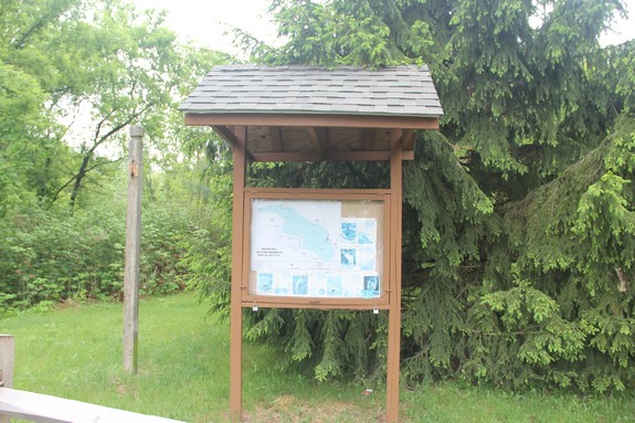
Indian Kill Nature Preserve. At the edge of the parking lot,
there is a kiosk with information and a map of the preserve.
We would recommend downloading a map prior to a visit here.
other than the one posted, they were not available at the kiosk
but are on-line.
From the parking area, you walk on what is known as the Claire
Schmitt Trail. A little over 100 yards from the trailhead,
you will come to the Indian Kill Dam. At that point you cross
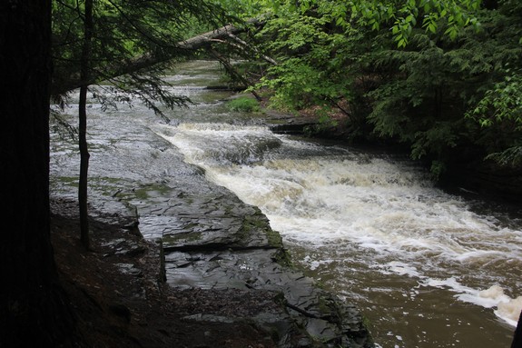
a footbridge and continue to the waterfalls. There are a number
of trails, but if properly armed with a map, you should have no
problem finding Third Falls, which is about 1/2 mile from the trailhead.
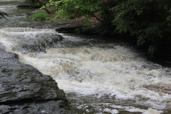
When we visited this area, our information wasn't clear.
Having thought we had seen both waterfalls, we turned around and
exited the facility at this point. In fact, we mistakenly
assumed that a smaller drop was Third Falls and that the final falls
we reached was Second Falls. If we had a printed map, we would
have realized that you need to cross the stream in the area of Third
Falls and continue hiking another 1/4 mile, where you will find
Second Falls.
our picture array shows the dam and Third Falls. Likewise,
the coordinates indicated are for Third Falls.
It looks like another trip to this facility is in order, this
time armed with a printed map. We have been contacted by a
waterfaller in that area who indicated that he will send us pictures
of Second Falls. In the meantime, if anyone else has any information,
please contact us.
According to the information provided, the waterfall known as
First Falls is actually upstream of the preserve, on private property
and is not accessible. If anyone has information or pictures
of this waterfall, we would greatly appreciate
hearing from you.
The Indian Kill flows into the Alplaus Kill, which empties into
the Mohawk River just east of Scotia. This flows to the Hudson
River before reaching the Atlantic ocean in New York City.
Last update: October 27, 2015
|