| Directions
In the village of Ticonderoga, NY 9N becomes Hague
Road from the south and Wicker Street from the north.
There is a traffic rotary at which point Hague Road
becomes Montcalm Street and Wicker Street becomes Lord
Howe Street. East of this rotary on Montcalm
Street, just past the Wiley Street/Schuyler Street intersection,
you will cross the La Chute River. Just past this on the
left there are a number of businesses and the local library. There
is a street/parking area behind these where you can
access this waterfall.
|
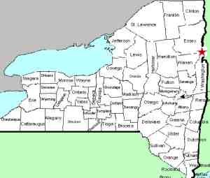
| County: |
Essex |
| Town: |
Ticonderoga |
| USGS Map: |
Ticonderoga |
| Waterway: |
La Chute River |
| Latitude: |
N 43° 50' 58" |
| Longitude: |
W 73° 25' 36" |
| Drop: |
NA |
| Type: |
Dam/ribbon cascade |
| Region: |
Downtown Ticonderoga |
| Parking: |
Unpaved lot |
| Trail type: |
Asphalt walkway/dirt |
| Length of hike: |
0.1 mile |
| Difficulty: |
Easy |
| Accessibility: |
Public |
| Name: |
Common |
|
 The La Chute River serves as the outlet from Lake George to Lake
Champlain. It is entirely contained within the town of
Ticondaroga. Depending upon the source, or where you start
and end your measurement, it is only three to four miles long.
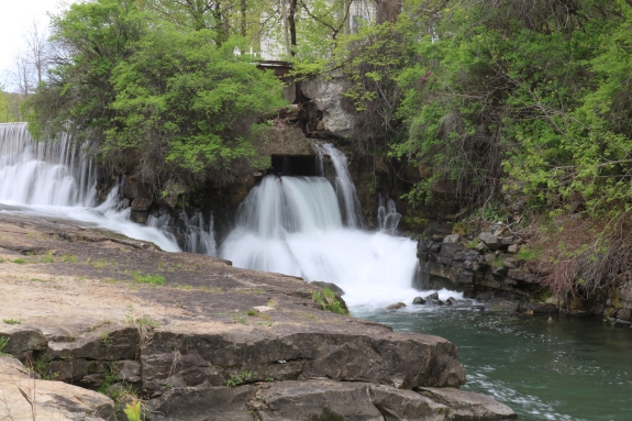
From the parking area described in the directions side-bar, you can
see the dam/falls a short distance off to your right. Richards Island Dam Falls is the
fifth from the top of the falls, second from the last, on this channel. The La Chute River serves as the outlet from Lake George to Lake
Champlain. It is entirely contained within the town of
Ticondaroga. Depending upon the source, or where you start
and end your measurement, it is only three to four miles long.
From the parking area described in the directions side-bar, you can
see the dam/falls a short distance off to your right. Richards Island Dam Falls is the
fifth from the top of the falls, second from the last, on this channel.
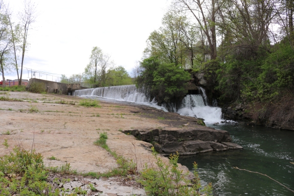
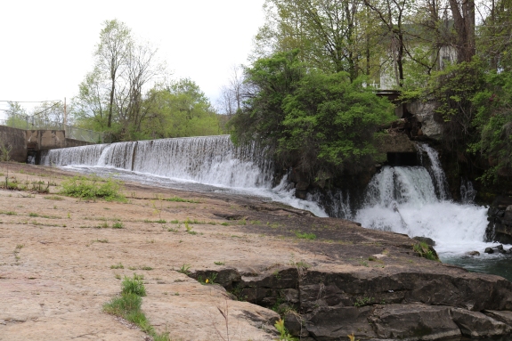
A number of dams have been constructed over the years
through this stretch. At most of them, there is still a
waterfall below the dam. Some of these still involve
active hydro-electric plants. The International Paper
Company at one time ran a number of mills located at the sites
of dams and falls along this stretch of the LaChute River.
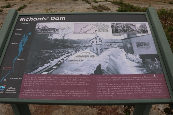
This location was known as the Richards Island Dam, leading to
its common name. The dam is still intact here and there is
a small ribbon cascade on river left next to it.
We did
find one curiousity about this location. Although it is
called the Richards Island Dam/Falls, we saw no presence of an
island! An information sign here, which we have pictured,
calls it the Richards' Dam. Topographical maps of the
area, as well as on-line satellite sources also do not show an
island. This is undoubtedly unimportant, but it does make
you wonder. La Chute is the outlet of Lake George and empties into Lake Champlain.
Last update: May 23, 2016
|