| Directions
Follow NYS Route 26 south out of Lowville
to the hamlet of Martinsburg and take a left on the
Glendale Road. Whitaker Park will be on your left
a short distance up the road.
|
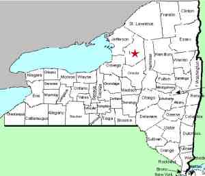
| County: |
Lewis |
| Town: |
Martinsburg |
| USGS
Map: |
Glenfield |
| Waterway: |
Roaring
Brook |
| Latitude: |
N
43° 44' 04" |
| Longitude: |
W
75° 26' 44" |
| Drop: |
~40' |
| Type: |
Multiple drops |
| Region: |
Near
Martinsburg |
| Parking: |
Unpaved
lot |
| Trail
type: |
Dirt/rock |
| Length
of hike: |
<
1/4 mile, one-way |
| Difficulty: |
Easy |
| Accessibility: |
Public |
| Name: |
Official |
|
 These falls are beautiful
and quite impressive, and they show what thousands of years of erosion
can do. This is very nice little town run park where you can
camp, picnic or just enjoy the falls or the scenery of the Black
River valley. Go straight at the intersection where you enter
the park. You will come to some buildings, including two pavilions
at the back of the park. There is a parking area there.
Signs direct you to the falls which is on the right at the back
of the park. Look for the wooden fence.
You will find an opening through which you can descend
to the river. The
walk from the parking lot to the falls is less than a quarter mile. These falls are beautiful
and quite impressive, and they show what thousands of years of erosion
can do. This is very nice little town run park where you can
camp, picnic or just enjoy the falls or the scenery of the Black
River valley. Go straight at the intersection where you enter
the park. You will come to some buildings, including two pavilions
at the back of the park. There is a parking area there.
Signs direct you to the falls which is on the right at the back
of the park. Look for the wooden fence.
You will find an opening through which you can descend
to the river. The
walk from the parking lot to the falls is less than a quarter mile.
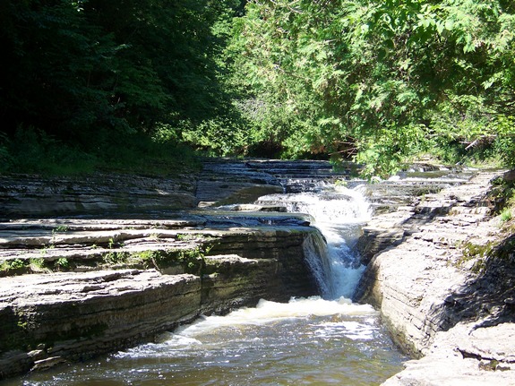
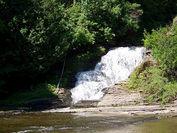
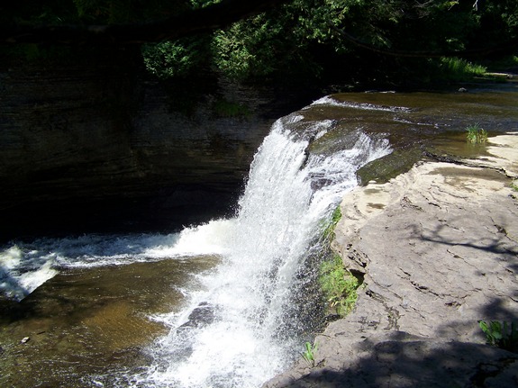
These falls descend through three drops. When you reach
the river you are just downstream from the top drop. The riverbed
here is made up of layers of fairly smooth rock. There is
usually enough dry space to access the bottom through a series
of natural rock steps.
The first video is of the main falls. The second one
also shows the lower drop.
Be advised that this facility is only open mid-May through
September. If you are planning a visit near the edges of
this time-frame, it would be wise to check to see if they are
open. According to their website, they can be contacted at
info@whitakerpark.com.
There is quite a bit of confusion about the name of this location.
The sign greeting you at the park identifies it as Whitaker Park.
Virtually everything you find on-line and in print about this park
calls it Whittaker Park. Even the road sign says Whittaker.
A telephone call to the Martinsburg Town Clerk has clarified this.
The family that settled in that area and donated the land for the
park was Whitaker, one "t". No one seems to know
how, why or when this happened, but over time, the name acquired
an extra "t" and became Whittaker. This is further
reinforced by a picture of an old post card obtained from the Lewis
County Historical Society. "Whitaker Falls" is imprinted
on it. In honor of the family whose name originally was the
source of this park and falls, we will use the original spelling.
Our application to have this falls listed on the USGS GNIS
was accepted on May 31, 2017. Whitaker Falls is now the
official name of this waterfall.
The Roaring Brook flows into the Black River just downstream
from the Whetstone Gulf area. The Black River joins Lake Ontario
just west of Watertown in Dexter, New York.
Last update: June 13, 2017
|