| Directions
This is a continuation of the hike to Hoffman Notch
First Falls.
|
| County: |
Essex |
| Town: |
North Hudson |
| USGS Map: |
Blue Ridge |
| Waterway: |
Hoffman Notch Brook |
| Latitude: |
N 43° 55' 37" |
| Longitude: |
W 73° 53' 42" |
| Drop: |
5' |
| Type: |
Cascade |
| Region: |
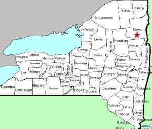
West of North Hudson |
| Parking: |
Roadside shoulder |
| Trail type: |
Dirt |
| Length of hike: |
3.0 mi, one-way |
| Difficulty: |
Moderate |
| Accessibility: |
Public |
| Name: |
Common |
|

From Hoffman Notch Lower Falls, continue up the trail
another 6/10 of a mile to reach Hoffman Notch Upper
Falls. You will see if from the trail, but like the
Lower Falls, it requires a little effort to get into
position for good photos.
This falls is 5'tall
Hoffman Notch Brook flows into the Branch, which empties into
the Schroon River just southwest of the hamlet of North Hudson.
The Schroon flows through Schroon Lake and then continues its journey
to the Hudson River just outside of the village of Warrensburg.
The Hudson flows into the Atlantic ocean in New York City.
Our thanks to Gary Dilmore for the photos and information on
this location.
Last update: September 7, 2026
|