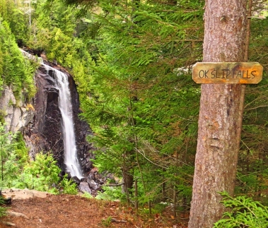
| Directions
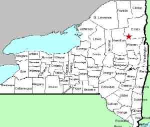
The parking area is located on NY 28, 7.5 miles east
of the junction of NY 28 and NY 30 in Indian Lake.
It is clearly marked.
|
| County: |
Hamilton |
| Town: |
Indian Lake |
| USGS Map: |
Dutton Mountain |
| Waterway: |
OK Slip Brook |
| Latitude: |
N 43° 48' 03" |
| Longitude: |
W 74° 06' 39" |
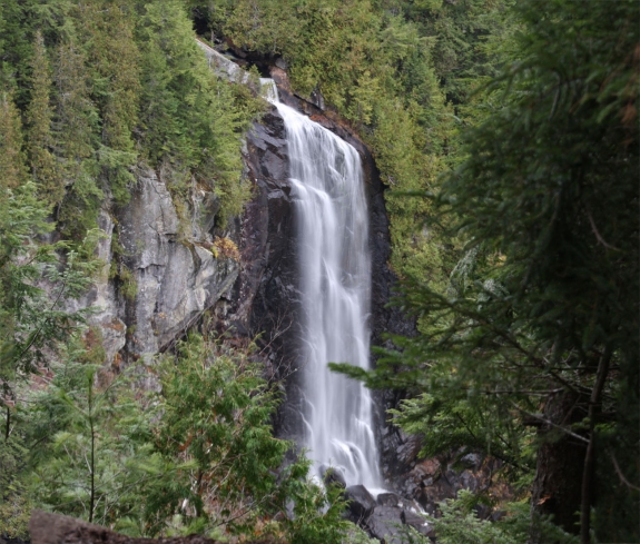
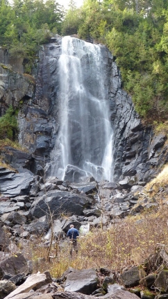
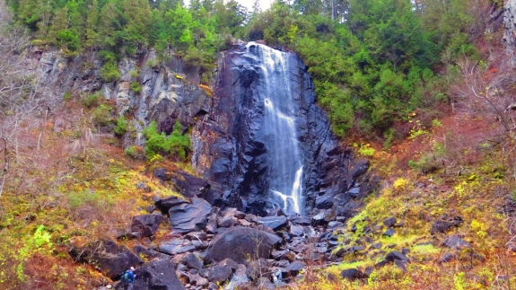
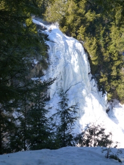
| Drop: |
250' |
| Type: |
Ribbon cascade |
| Region: |
East of the hamlet of Indian Lake |
| Parking: |
Unpaved lot |
| Trail type: |
Dirt |
| Length of hike: |
3.25 miles, one-way |
| Difficulty: |
Moderate |
| Accessibility: |
Public |
| Name: |
Common |
|
 From the parking lot, walk down (west) on NY 28. In about
1/4 mile, there is a DEC marked trailhead on the north side of
the highway. That would be on the opposite side of 28 from
the parking area. A short distance in the trail, you will
come to a registration kiosk. From the highway, the falls
is about a 3 mile hike. From the parking lot, walk down (west) on NY 28. In about
1/4 mile, there is a DEC marked trailhead on the north side of
the highway. That would be on the opposite side of 28 from
the parking area. A short distance in the trail, you will
come to a registration kiosk. From the highway, the falls
is about a 3 mile hike.
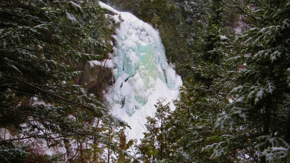
OK Slip Falls is promoted as the Adirondack's highest
waterfall and "one of the tallest waterfalls in the state."
For many years, this area has been privately owned, and only viewable
from a distance, but that has now changed. The NYS DEC has
purchased a sizable amount of remote Adirondack land, including
OK Slip Falls. The waterfall is now accessible by a
clearly marked DEC maintained trail.
The acquisition of the
land by the state has caused quite a bit of excitement in the hiking
and waterfalling communities. It was about 150 years
since the public has been able to get into this area.
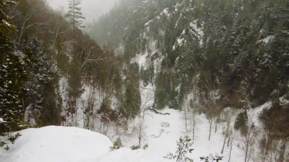
As you hike, you will cross several creeks. Carefully
placed stones and wooden bridges allow you to pass without
getting wet. At one point, you will come to a sign that
indicates that the waterfalls is 2.3 miles ahead. That is
the last indication you will have of how far you need to
proceed. Trail markers are prominent in pointing the way
however.
Although the trail is clearly marked, there are some issues
that are not as clear. Just short of 3 miles in the trail,
a sign stating "Trail" with an arrow pointing to the right.
In the arrow is written "Falls". You are almost there.
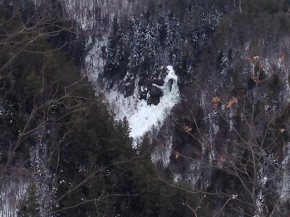
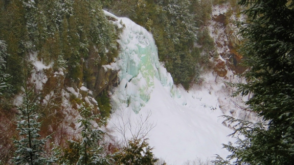
In about 200 feet, there is an overlook with a view of the
waterfall across the "canyon". The trail was created
around 2016 and over the years, the trees have grown so that
some of the view is now partially obscured. It might be
wise to make this trip in the early part of the season when
foliage is not as heavy. You may, however, encounter
wetter conditions at that time.
A bit further along the trail, there is another overlook.
These two vantage points will be where most hikers will get the
best views and pictures.
For those more daring, possibly a bit younger, there are two
options to reach the base of the waterfall. If you
continue past these overlooks, the trail will descend ... and
deteriorate! At some point in the past, this was the path
of choice but since the state obtained the land, it is no longer
maintained. You may note the absence of the trail markers
that had been prevalent previously. Having said this, we
did not attempt this path but did talk with hikers who had
encountered others who had successfully navigated this route.
Actually, we started to try this out but it didn't end well.
We'll let it go at that.
Option two is to hike back to that sign with the arrow that
we previously mentioned. There is another trail that veers
off in the direction opposite the arrow. A few hundred
yards down this trial ... which does have markers! ... you will
reach the OK Slip Brook. You will actually see the crest
of the waterfall just downstream of where a bridge crosses the
brook. Our information is that if you cross the bridge and
continue along this trail, you will eventually reach the Hudson
River. At that point, head downstream and you will soon
come to the outlet of the OK Slip Brook. A rock hop up the
brook will bring you to the base of the falls. According
to topographical maps, this route will increase you hike by a
little over a mile, if you could do it in a straight line.
With all of the ups and downs and switch backs, it will probably
be closer to 1.5 to 2 miles.
The OK Slip Brook empties into the Hudson River less than 1/2
mile downstream from this location. The Hudson flows into
the Atlantic Ocean in New York City.
Last update: July 26, 2021
|