| Directions
Follow CR 2 to the Hamlet of Ironville NY, just
outside of Crown Point. Depending on the direction
you are coming from, turn onto Peasley Road and
follow the road for about 100 yards. There is a
small lot on the right side just before the bridge
over Putnam Creek. AllTrails lists the address as
Old Iron/Penfield Pond Trailhead.
|
| County: |
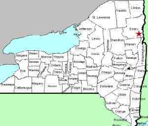
Essex |
| Town: |
Crown Point |
| USGS Map: |
Crown Point |
| Waterway: |
Putnam Creek |
| Latitude: |
N 43°
55' 17" |
| Longitude: |
W 73°
32' 09" |
| Drop: |
12' |
| Type: |
Step cascades |
| Region: |
West of Crown
Point |
| Parking: |
Unpaved lot |
| Trail type: |
Dirt/rock/grass |
| Length of hike: |
0.4 mile,
one-way |
| Difficulty: |
Easy |
| Accessibility: |
Public |
| Name: |
Unnamed |
|
From the parking lot, start walking over the bridge.
While on the bridge, if you look downstream you will
see the water disappear over a ledge, between two large
boulders. It looks like there could be a beautiful
waterfall there but it is posted as private property on
both sides of the creek and a house is nearby so we did
not attempt to investigate further.
Continue
across the bridge, turn right and enter the trail on the
river left side of Putnam Creek, facing upstream.
Follow the trail, staying along side Putnam Creek.
Along the way you will pass some small cascades and
some historical artifacts. Ironville has some
interesting history with the entire hamlet listed on the
National Register of Historical Places.
When you
are approximately 4/10 of a mile from the parking lot,
the main trail will veer to the left and you will see a
small path to the right. Go to the right and work
your way over to the outlet of the pond for a view of
this 12' cascade where Putnam Creek flows out of
Penfield Pond.
After viewing the falls you can retrace your steps back
to the parking lot or continue on the trail to complete
the 1.7 mile loop. If you have time, check out the
Hamlet of Ironville.
Webmaster's note: We take the liberty of assigning
names to unnamed waterfalls simply for the sake of cataloging
them. Usually, we will use the name of the waterway where
the drop is located. In the event there may be more than
one waterfall on that stream, we will go with an alternative
possibly involving a town, village, hamlet or other landmark.
Because there are multiple falls on Putnam Creek, we were
leaning toward Ironville Falls because of this falls' location.
However, we already have another Ironville Falls in this region.
Often, we will assign an unnamed waterway as the outlet of a
given pond. In this case, the outlet refers to the fact
that this drop is literally at the point where Penfield Pond
enters Putnam Creek, hence Penfield Pond Outlet Falls
Putnam Creek flows directly to Lake Champlain. Its
outlet is in the region of Gilligans Bay, just east of Crown
Point
Last update: September 23, 2026
|