Northern New York Waterfalls
Home Alphabetical List County List Listed By River  Bookstore  Official Falls  Submit Pics  Credits
Slideshow  Definitions  Disclaimers  Rivers of NY  Covered Bridges Coordinate Conversion Contact Us  Links 

Woodland Falls

Directions

Drive to the Putnam Pond Campground, 763 Putts Pond Road, Ticonderoga, NY.  Stop at the entrance gate attendant booth to pay the day use fee.  This is waived if you are 65 years or older and a NYS Resident. From the booth, drive straight ahead for about a half mile. The road will eventually circle around to the left and bring you into the day use parking lot.

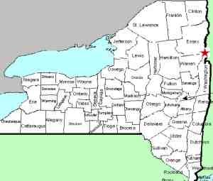
County: Essex
Town: Ticonderoga
USGS Map: Graphite
Waterway: Rock Pond Brook
Latitude: N 43° 51' 10"
Longitude: W 73° 36' 29"
Drop: 30'
Type: Two-tiered
Region: Remote area east of the community of Ticonderoga
Parking: Unpaved parking area
Trail type: Dirt
Length of hike: 7.9 mi round-trip
Difficulty: Moderate to vigorous
Accessibility: Public
Name: Common

Graphite Quadrangle

An Internet website does refer to this waterfall as Rock Pond Brook Falls.  However, a map available at the campground office refers to it as Woodland Falls.  Since it is their waterfall, we are going with that!

As for the length of this hike, note that the distance noted in the data side-bar includes the hike posted as Rock Pond Brook Tributary Falls.  This drop can be viewed on the return from that hike.  It is possible to hike directly to this site but then you would miss the falls on the tributary!

From Rock Pond Tributary Falls, continue west on the Rock Pond to Lilypad Pond Trail for about half a mile.  As the trail goes down a hill and circles around to the right, you will hear and see Woodland Falls on your right. At the bottom of the hill there is a path on the right that will lead you to the base of the falls.  

They is a beautiful 30' waterfall, the top portion being about 20' falling into a pool and the lower portion being about a 10' drop.

After viewing the falls, you can either retrace your path back to the parking lot or do what we did, when you get back to Rock Pond, we completed the loop around the south side of Rock Pond, which is actually a little shorter and easier to navigate.

After viewing the falls, return to the trail and continue on the Woodland Falls.

Rock Pond Brook flows into Crane Pond.  From there, it continues to Alder Pond which flows into Alder Creek which joins Schroon River just north of Schroon Lake near the community of Schroon Lake.  This waterway flows into the Hudon River when joins the Atlantic Ocean in New York City.

Webmaster's note:  Our thanks to Gary Dilmore for the pictures, directions and information on this waterfall.

Last update:  September 8, 2026

Hover on any of the thumbnails to see an enlarged image

Woodland Falls Woodland Falls
Woodland Falls

©2026
Reproduction of this World Wide Web Site in whole or in part is prohibited without permission. All rights reserved.
 Trademarks and copyrights are the property of the respective owners and may not be used without permission.
nnywaterfalls.com is a service of Fourth Coast Creations