| County: |
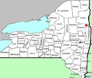
Warren |
| Town: |
Bolton |
| USGS Map: |
Silver Bay |
| Waterway: |
Clay Meadow Trail Creek |
| Latitude: |
N 43° 37' 30" |
| Longitude: |
W 73° 35' 15" |
| Drop: |
20' |
| Type: |
Multi-drop cascade |
| Region: |
Off NY 9N north of Bolton Landing |
| Parking: |
Unpaved lot |
| Trail type: |
Dirt |
| Length of hike: |
2.0 mile
one-way |
| Difficulty: |
Moderate |
| Accessibility: |
Public |
| Name: |
Unnamed |
|
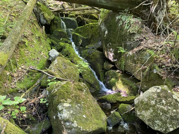
From Clay Meadow Upper Falls #8 hike upstream for about
10 minutes to reach the base of Clay Meadow Upper Falls
#9. This is one of those falls that is hard to tell
where it starts and ends because it just keeps going.
I'm going to call it a total of 20' in height with 4-5
sections.
I worked my way up around some
downfall and large boulders, then when it looked like
too much effort to go any further, I retreated
downstream a bit and then headed through the woods on
the river right side to pick up the trail to head back
to my car.
Our thanks to Gary Dilmore for the photos and information about
this waterfall location.
The creek containing this waterfall flows into the Northwest
Bay Brook. That empties into Lake George. The water
from this then flows through La Chute in Ticondaroga and ends up
in Lake Champlain. The flow then goes north through Canada
on the Richelieu River and empties into the St. Lawrence River.Last update: October 2, 2026
|