| Directions
East of Newcomb on NY 28N, take a left on the Blue Ridge
Road. A short distance in, you will want a left on
the Tahawas Road. Bear left on the Upper Works
Road and follow this to the Upper Works parking area.
|
| County: |
Essex |
| Town: |
Newcomb |
| USGS Map: |
Mt Marcy |
| Waterway: |
Allen
Brook |
| Latitude: |
N 44°
04' 22" |
| Longitude: |
W 73°
56' 57" |
| Drop: |
8' |
| Type: |
Ribbon
Cascade |
| Region: |
Remote
Adirondacks west of Upper Ausable Lake |
| Parking: |
Unpaved
lot |
| Trail type: |
Dirt |
| Length of hike: |
8.4
miles, one-way |
| Difficulty: |
Strenuous |
| Accessibility: |
Public |
| Name: |
Common |
|
The information and pictures of this waterfall were submitted by
a contributor. Our thanks to John Holmes who has made this
hike. He has provided the pictures and directions,
complete with coordinates and a topographical map segment of his
hike.
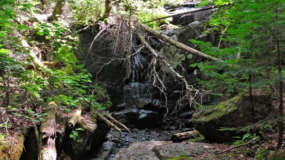
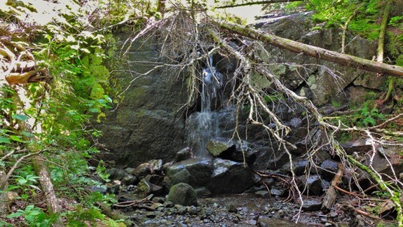
Be aware that this one is not for the faint
of heart. The Allen Brook is along the beginning of the
trail leading to Allen Mountain. At 4340', Allen is the
26th highest peak in New York's Adirondack Mountains. It
is often promoted as the most difficult of the Adirondack 46
High Peaks
to climb. Having said that, the waterfall is at the base
of Allen Mountain and marks the beginning of the ascent.
You are still a mile or so from the top of the mountain but is still a
healthy hike to the falls.
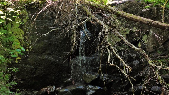
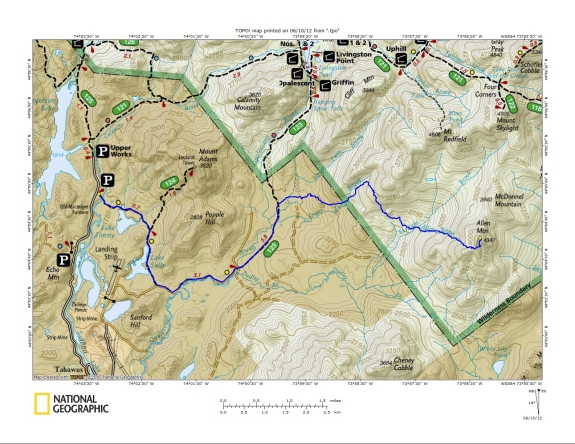
The trail to Mount Allen Falls starts at
the Upper Works (N 44.080845, W 74.054883). The trailhead
is just past the old McIntyre Furnace. The trail follows the
trail to Adams until you get to the cabins (N 44.078817, W
74.042017). At the cabins you split off the trail to Adams and
follow the yellow trail markers. At about the 6 mile point you
will be getting off the marked trail because the remainder of
the trail to Allen is a herd path.
Continue on the trail and you will reach the spot
you have to cross the Opalescent River (N 44.064045, W
74.01253). Keep following the trail and you will eventually get
to where the original start was before moving it back at the
Upper Works. This spot will have another sign in. (N 44.076799,
W 73.993867). After signing in you will continue on the same
trail until you get to the base of Allen Mountain. That is where
Allen Brook Falls is (N 44.073442, W 73.955799). From that
point it is a mile to the summit of Allen. The hike to Allen's
peak and back is 18.8 miles so Allen Falls would be around 8.4
mile from the start of the Upper Works trail head.
Allen Brook flows into Skylight Brook which, in turn, flows into
Dudley Brook. This terminates at the Opalescent River
which empties into the Hudson River just south of Tahawus, a
former mining community. The Hudson flows into the
Atlantic Ocean in New York City.
Last update: May 21, 2016
|