|
What is Northern New York?
 To
anyone not living in New York State and to anyone who lives
in New York City or Long Island, New York is pretty much divided
into two regions, downstate and upstate. Downstate is
New York City and Long Island, and perhaps a part of Westchester
County, if you stretch it. Upstate is everything else.
To those of us in New York State proper, there are sub-regions
within the state. We recognize Western New York or the
Greater Niagara Region, the Finger Lakes, Central New York,
the Leatherstocking Region, the Catskills, the Hudson Valley,
the Capital Region and Northern New York, also known as the
North Country. There may be other regions as well, but
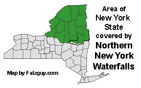
for the purpose of this website, Northern New York is that portion
of the state bordered by Lake Ontario on the west, the St. Lawrence
River and the border with Canada on the north and Lake Champlain
and the Vermont border to the east. We consider our southern
border, from west to east, to be the combined waterways of the
Oswego River, the Oneida River, Oneida Lake, the Erie Canal
and the Mohawk River. Where the Mohawk meets the
Hudson north of Albany, we go upstream to where, just above
the Hoosic River, the Washington/Rensselaer County line goes
due east to the Vermont state line. The New York State tourism community
divides this area into the Adirondacks and the Thousand Islands-Seaway
region. To
anyone not living in New York State and to anyone who lives
in New York City or Long Island, New York is pretty much divided
into two regions, downstate and upstate. Downstate is
New York City and Long Island, and perhaps a part of Westchester
County, if you stretch it. Upstate is everything else.
To those of us in New York State proper, there are sub-regions
within the state. We recognize Western New York or the
Greater Niagara Region, the Finger Lakes, Central New York,
the Leatherstocking Region, the Catskills, the Hudson Valley,
the Capital Region and Northern New York, also known as the
North Country. There may be other regions as well, but
for the purpose of this website, Northern New York is that portion
of the state bordered by Lake Ontario on the west, the St. Lawrence
River and the border with Canada on the north and Lake Champlain
and the Vermont border to the east. We consider our southern
border, from west to east, to be the combined waterways of the
Oswego River, the Oneida River, Oneida Lake, the Erie Canal
and the Mohawk River. Where the Mohawk meets the
Hudson north of Albany, we go upstream to where, just above
the Hoosic River, the Washington/Rensselaer County line goes
due east to the Vermont state line. The New York State tourism community
divides this area into the Adirondacks and the Thousand Islands-Seaway
region.
The majority of this region contains the Adirondack State
Park region, which contains all or part of eleven counties.
Essex and Hamilton Counties are entirely contained within
the park's boundaries. Also included are parts of Clinton,
Franklin, St. Lawrence, Lewis, Herkimer, Fulton, Saratoga,
Warren and Washington Counties. Jefferson County is obviously in Northern New
York and we are also including the northern parts of Oswego, Oneida, Montgomery
and Schenectady Counties. There might be an argument that
some of these counties fall in Central New York or the Capital
Region, but for the most part, the waterways in these counties
flow into the eastern end of Lake Ontario, the St. Lawrence
River, Lake Champlain, the Mohawk or Hudson Rivers. For
the most part, these waterways trace their source to the Adirondacks
or its foothills.
To those who know the Adirondacks, whether they be residents,
relocated natives or visitors to the region, this area is recognized
as being as beautiful as any area New York State, the
U.S. or the world, for that matter, has to offer. From
it majestic high peaks, inland lakes, rivers and streams, to
its many popular tourist destinations such as Lake Placid, Tupper
Lake, Saranac Lake and Lake George, its natural beauty is unrivaled.
Outside of the Adirondacks, northern New York boasts the eastern
shores of Lake Ontario, the St. Lawrence River Valley and Lake
Champlain, some of the most gorgeous navigable waterways in
the North American continent.
Our thanks to Scott Ensminger of
falzguy.com
for the map of New York State depicting our region.
|
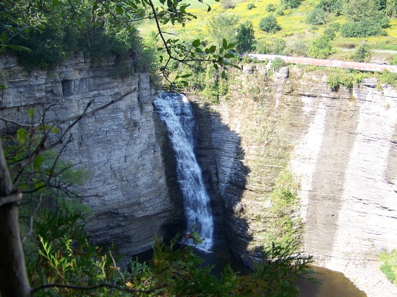
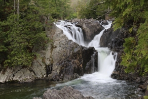
What is a waterfall?
According to Webster's Dictionary, a waterfall is "a
fall, or perpendicular descent of the water of a river or stream,
or a descent nearly perpendicular; a cascade, a cataract."
Further definitions of cascade and cataract both use the word
precipice, whose definition includes the term "headlong
fall." Accounts in the Encyclopedia Britannica support
this definition. Realistically, many people think of something
like Niagara Falls or Bridal Veil Falls when they think "waterfall".
In reality, the concept of waterfall goes well beyond this.
Literally, a waterfall is "falling water". How
far and how fast is where the line is drawn. When all
of the definitions are considered, it appears that many of the
waterfalls in Northern New York are actually rapids.
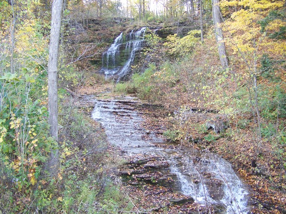
Having said that, for the purposes of this website, we are
taking on a broader definition. If it is a named waterfall
in Northern New York, we will include it here. If it is
not a named waterfall, it will still be included if the vertical
fall of its path is equal to or greater than its horizontal
flow. Furthermore, if there is a considerable vertical
drop, even over a considerable horizontal flow, it will still
be included. It is interesting to note that many unnamed
waterfalls are found on topographical maps and are indicated
simply as "falls". Many of these are smaller
than a number of falls that aren't even listed. There
doesn't seem to be a standard as to how or why these were included
on these maps when they were originally developed.
We don't mean to make light of this or to upset the diehard
waterfall purist. This website is more concerned with
the aesthetics of falling water rather than the geological,
engineering or technical aspect of the discussion. For
that reason, we are also including named rapids. After
all, rapids are falling water where the flow is not falling
vertically as fast as it is running horizontally.
|
USGS/GNIS
The United States Geological Survey (USGS), which is a part
of the US Department of the Interior, is responsible for the
official naming of geographic locations in our nation.
Things like towns, cities, mountains, rivers and waterfalls
are listed on the Geographic Names Information System (GNIS).
The GNIS is a database of all things officially named.
For our purposes, we will consider three categories of naming.
- Official ... a waterfall that is listed on the GNIS
- Common ... in the big picture, most waterfalls are not
included in the GNIS database. Many waterfalls that
are not on this list do have a common name that is used,
perhaps by those local to that area or perhaps on a wider
base.
- Unnamed ... Many waterfalls do not have a name, either
by official standards or common reference. In these
cases, we have taken the liberty to give them a name, usually
based on the waterway they are on, to facilitate cataloging
them. We have observed that, over the past few years
that this website has been in existence, waterfalls that
we have given informal names have turned up on other websites
with that name. This is one way that common names
develop!
|
Waterfall page
lay-outEach waterfall page will show a directions side-bar
on the top-left giving brief, but concise directions for getting
to that waterfall. Please understand that, in many
cases, if you are approaching a location from a less
traveled direction, there may be a shorter route than the
one noted. Our directions are usually based on the
most commonly traveled approach.
Below the directions will be a data side-bar
which includes several important pieces of information on the
fall. Specific details on that are in the next section.
Below that is a New York State map depicting a red star which
shows the general location of the waterfall.
In the column at the right of these items is a narrative
discussion of the specifics of the falls. Below all of
this will be an array of thumbnail photos. Hovering on
any of the photos will cause an enlargement to pop up on the
right.
|
Using the data
side-bar
On each waterfall page, there is a two-column data side-bar
containing many pertinent items of information, as follows:
|
County: |
The county within which the waterfall
is located |
|
Town: |
The township of the waterfall location.
In New York State counties are divided into townships. |
|
USGS Map: |
The United States Geological Survey
is a scientific agency of the US government. Among
other things, they publish several series of topographical
maps that are considered to be a leading resource for
locating items in the more remote areas of the nation.
In addition, this agency is charged with naming geographic
entities such as mountains, rivers, lakes and waterfalls. |
|
Waterway: |
The river, stream, creek or other waterway
on which the waterfall is located. |
|
Latitude: |
The geographic latitude of the waterfall's
location. Since all points in North America are
north of the equator, all locations are positive readings.
For the sake of consistency, these are given as N followed
by dms format, which is consistent with the USGS GNIS
data base. |
|
Longitude: |
The geographic longitude of the waterfall's
location. Since all points in North America are
west of the prime meridian, all locations are technically
negative readings. For the sake of consistency,
these are given as W followed by dms format, which is
consistent with the USGS GNIS data base. It is
important to note that a negative longitude is the same
as a positive west longitude. |
|
Drop: |
The height of the waterfall, expressed
in feet, often estimated. |
|
Type: |
The type of waterfall, using a system
developed by nnywaterfalls.com, explained in detail
below. |
|
Region: |
For the ease of our readers who are
planning a trip to view more than one waterfall, this
will be a way of locating the general area within the
information previously given. |
|
Parking: |
Parking facilities at the site, which
may include 1) paved lot, 2) unpaved lot or 3) highway
shoulder |
|
Trail type: |
The composition of the trail leading
to the waterfall site. Some may be indicated as "roadside"
which means no hiking is involved. |
|
Length of hike: |
The distance/average time for reaching
the site from the parking area. |
|
Level of difficulty: |
Easy ... a stroll in the park; Moderate
... fairly easy walk but may include brief up or down
hill sections or mild obstacles; Rigorous ... a bit
more challenging either due to more involved obstacles,
up or downhill sections, or longer distance; Intense
... a true hiking challenge; Bush-whack ... sections
where the trail is missing or eroded or, in some cases,
doesn't exist and never did! |
|
Accessibility: |
Public ... public land and openly accessible
or privately owned with viewing permission granted;
Private ... private land, posted or otherwise; Business
... private property but a business is being operated
at the premises and viewing is allowed through the business. |
|
Name: |
Official, Charted, Common or Unnamed, as per
the discussion above about the USGS GNIS. |
A note about latitude and
longitude
We use a computer program that is a collection of
topographical maps of New York State. This program is
based on the USGS quadrangles which were developed many
years/decades ago. We also use a modern hiking style
GPS unit. Based on several years of the use of these
together, we have noted that we will frequently get
discrepancies between the readings of where our waypoints
are marked on the GPS unit and what the map might show.
For example, we have taken readings where we were literally
in the water at the base of a waterfall, but when we spotted
this point on the map, it was not on the waterway, but on
land near it. These discrepancies have never been huge
so we do not feel that it is a significant issue. We
do, however, want to note that the coordinates listed on any
of our pages are as close to accurate as possible but due to
factors beyond our control, there may be a small margin of
error.
Waterfall Types
Many waterfall websites and books use no less than a dozen
terms to "type" waterfalls according to their physical
attributes. It is also common to classify waterfalls according
to the average volume of water in the fall using a ten point
logarithmic scale. There are also references where the
term classification was used to discuss the physical appearance
of the falls. We have been saying for years that there
is no standard for classifying or typing waterfalls.
We will stick with that statement. However, in recent
years, and we don't know who to credit, several websites
have adapted terms that are closing in on becoming standard.
There are still some variations but, because of these recent
developements, we are in the process of introducing these
new terms on this site. Because of the sheer number of
falls we have listed, this is going to take some time.
The following represents those terms we are adapting.
|
Plunge |
The water drops vertically in a headlong
dive, usually falling free of all or most of the
underlying surface. |
 |
|
Block |
Water which usually falls from the entire width of a
stream in one primary drop while maintaining some contact
with the underlying cliff. It may contain
additional drops incidental to the primary one.
This is considered the classical style of waterfall.
This will be broken down into Rectangular Block, where
the width at the crest of the falls is obviously
greater than its height, Square Block, where the
width and height are relatively equal, or Ribbon
Block, where the width is noticably less than the
height. |
 |
|
Cascade |
A waterfall containing multiple drops or a series of
muliple drops. This may also be sub-divided
into Curtain Cascade, Square Cascade or Ribbon
Cascade, as described above, of Step Cascade, which
descends in a series of drops, resembling stair
steps. |
 |
| Slide |
A relatively smooth descent, resembling a natural
waterslide. |
 |
|
Segmented |
Characterized by more than one drop on the same
level usually
created by small islands or protruding rock |
 |
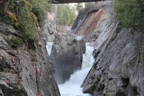
| Flume |
A section of waterway where the channel
narrows, usually between steep walls, causing the flow
to increase. |
 |
|
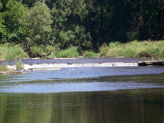
Ledge |
Similar to a Block, but a short drop of only a few
feet, usually spanning the width of the stream. |
 |
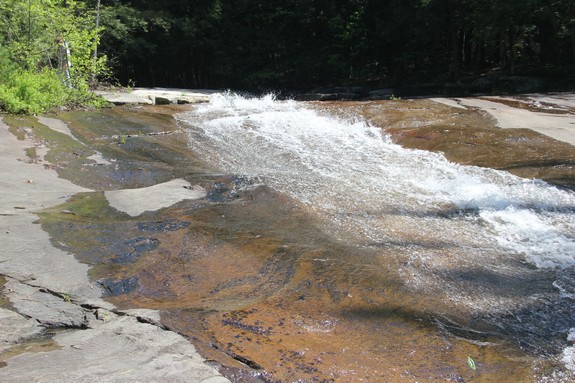
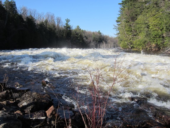
| Rapids |
When the overall fall of the water level
is noticeably less than the horizontal run of the section |
 |
| Historical |
A waterfall that no longer exists.
This is usually due to the establishment of a power
dam at that location that has eliminated the falls but
is not limited to that reason. |
|
More often than not, a waterfall demonstrates more than one
of the above properties. In those cases, efforts are made
to classify the section based on the most obvious attribute.
When that is not possible, it will be noted that the waterfall
is a combination of more than one type. There are also
some locations where more than one waterfall is present.
In these cases, we have noted that there are "multiple"
waterfalls.
|
|


