| Directions
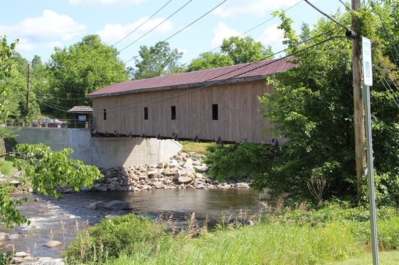
Take the John Fountain Road which is located directly
across from where NY 86 converges with NY 9N in the village
of Jay. The Brick Store Lane will be on your right
at the bottom of the hill. A small parking area is
provided next to the covered bridge there. There is
also another parking area on the other side of the bridge,
but vehicle traffic is not allowed on the bridge.
|
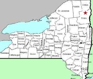
| County: |
Essex |
| Town: |
Jay |
| USGS Map: |
Lewis |
| Waterway: |
Ausable River, East Branch |
| Latitude: |
N 44° 21' 57" |
| Longitude: |
W 73° 50' 29" |
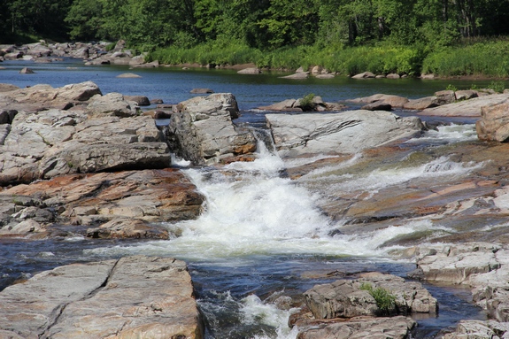
| Type: |
Slide |
| Drop: |
10' |
| Region: |
In the hamlet of Jay |
| Parking: |
Paved lot |
| Trail type: |
Concrete and wood |
| Length of hike: |
0.1 mile/1 minute |
| Difficulty: |
Easy |
| Accessibility: |
Public |
| Name: |
Common |
|
 Jay, New York is one of many quaint
villages and hamlets in the Adirondack Mountains of northern New
York. Located right on State Highway 9N, the falls are easy
to locate and provide a roadside view. Jay, New York is one of many quaint
villages and hamlets in the Adirondack Mountains of northern New
York. Located right on State Highway 9N, the falls are easy
to locate and provide a roadside view.
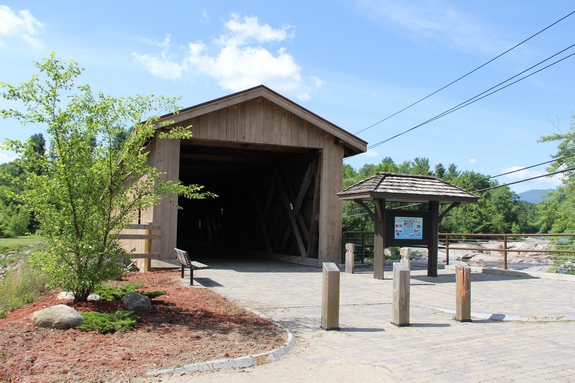
According to the New York State Covered Bridge Society there
are 24 remaining covered bridges in the state. Our
research has determined that Jay Falls is one of four waterfalls with a
covered bridge nearby.
Beecher Falls in
Saratoga County, Spruce Creek Falls
in Herkimer County and Lower
Falls in Essex County
are the other three. The claim is made that Jay Bridge is the
only remaining publicly owned covered bridge in the Adirondack region.
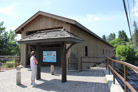
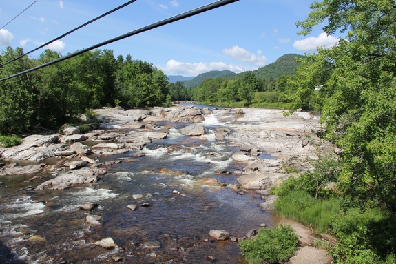
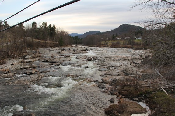
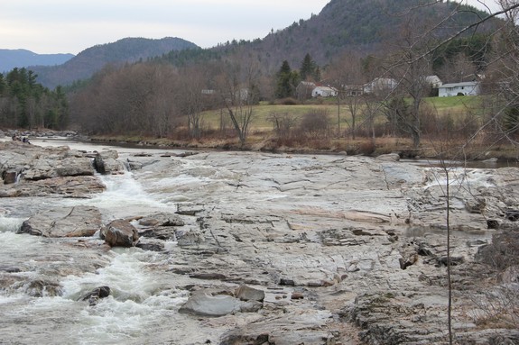
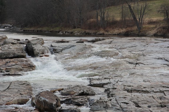
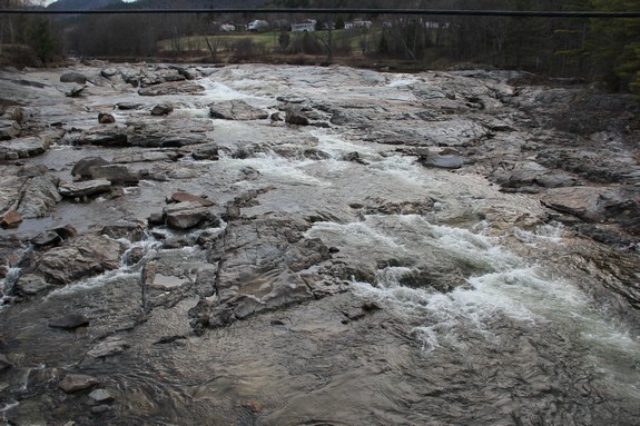
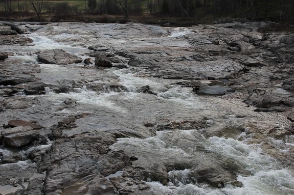
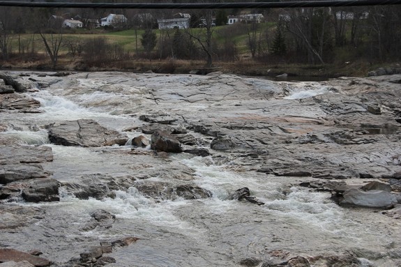
The falls are just upstream and can easily be seen from the bridge.
During heavy spring run-off, most of the width of the river might
be covered with water. Flooding during this time of the year
is common just upstream from here. During the summer, the
flow will diminish and you will only see a couple of small slides
at the upper portion of this stretch.
The Ausable River East Branch joins forces with the West Branch
in Ausable Forks. The combined Ausable River empties into
Lake Champlain in the town of Peru.
Last update: May 24, 2016
|