| Directions
This waterfall is on private property and is not publicly
accessible.
|
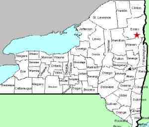
| County: |
Essex |
| Town: |
Keene |
| USGS Map: |
Keene Valley |
| Waterway: |
Ausable River, East Branch |
| Latitude: |
N 44o 9' 9" |
| Longitude: |
W 73o 46' 53" |
| Drop: |
NA |
| Type: |
NA |
| Region: |
off NY 73 near the hamlet of St. Huberts |
| Parking: |
NA |
| Trail type: |
NA |
| Length of hike: |
NA |
| Difficulty: |
NA |
| Accessibility: |
Private |
| Name: |
official |
|
This waterfall is located very close to the Ausable Club's Adirondack
Mountain Reserve. When we were hiking at the AMR, we asked
a club employee about Russell Falls. He informed us that it
is on private property. He also indicated that it is a very
dangerous area and that at least one death has occurred there.
Due to dense foliage in this forest area, even Bing and
Google satellite images do not show the waterfall. If anyone has any information about this waterfall, we would
be very interested in
hearing from you.
The East Branch of the Ausable River joins forces with the west
branch downstream at Au Sable Forks to form the Ausable River.
This waterfall rich river empties into Lake Champlain in the town
of Peru.
Last update: July 27, 2015
|


