| Directions
From NY 812 in the village of Croghan, turn on to Bridge
Street, which becomes Resha Road. This location is
almost immediately on your left.
|
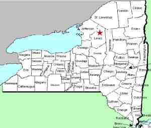
| County: |
Lewis |
| Town: |
Croghan |
| USGS Map: |
Croghan |
| Waterway: |
Beaver River |
| Latitude: |
N 43o 53' 55" |
| Longitude: |
W 75o 23' 36" |
| Drop: |
11' |
| Type: |
Dam |
| Region: |
In the village of Croghan |
| Parking: |
Unpaved lot |
| Trail type: |
NA |
| Length of hike: |
NA |
| Difficulty: |
Easy |
| Accessibility: |
Business |
| Name: |
Common |
|
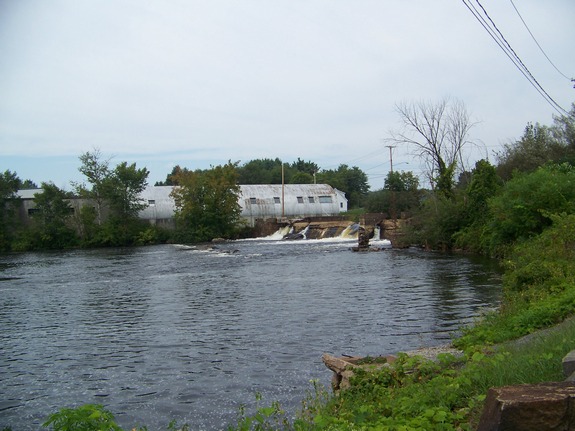
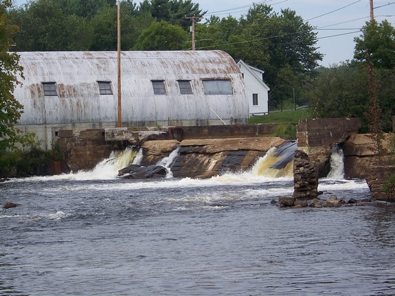
Croghan Island is an interesting place. There
is a mill there that still operates on the power provided by the
dam. This is an unnamed area where the Beaver River flows
around an island. Apparently there once was a small waterfall
located there but a power dam was built for the mill. A retaining
dam was placed on the main channel but it is seriously deteriorating.
These pictures are of the retaining dam.
The Beaver River flows into the Black River, which empties into
Lake ontario at the Black River Bay, just southwest of the village
of Dexter.
Last update: July 28, 2015
|