| Directions
Take the Belfort Road from the village of Croghan to
Belfort. As you approach Belfort, continue on the
Effley Falls Road. At some point, the Effley Falls
Road actually turns left. You want to continue
straight here onto the Hogsback Road. This will end at the Soft Maple
Road where you should turn left. In the area of Soft
Maple, turn left on the Beaver River Road. Knowing
that this is the name won't help you because it isn't
labeled. There is a sign here indicating the Adsit
Trail. Another marker here is a dead end sign on
the road you turned off from. You will pass the
Soft Maple Hydro Plant on this unpaved road and in about
one mile, look for a small parking area on the left with
a sign indicating "Scenic Overlook".
|
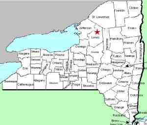
| County: |
Lewis |
| Town: |
Croghan |
| USGS Map: |
Stillwater |
| Waterway: |
Beaver River |
| Latitude: |
N 43o 55'
03" |
| Longitude: |
W 75o 13' 42" |
| Drop: |
30' |
| Type: |
Ribbon Cascade |
| Region: |
East of Croghan |
| Parking: |
Unpaved lot |
| Trail type: |
Dirt |
| Length of hike: |
5 minutes |
| Difficulty: |
Easy |
| Accessibility: |
Public |
| Name: |
Unnamed |
|
 Several
stretches on this route are unpaved. You need to be
espectially mindful of the point where the Effley Falls Road
becomes the Hogsback Road and also where you turn onto the Adsit
Trail. There is also a hand lettered sign at this corner
noting the Soft Maple Campground. Several
stretches on this route are unpaved. You need to be
espectially mindful of the point where the Effley Falls Road
becomes the Hogsback Road and also where you turn onto the Adsit
Trail. There is also a hand lettered sign at this corner
noting the Soft Maple Campground.
From the parking area, proceed down the trail.
Within a minute or so, you will reach the river's edge, and from there
you can walk up the bank and actually access the top of the falls.
There may be some rock-hopping necessary because there are actually
two waterfalls here. On our latest trip we were greeted by
some chain link fencing, presumably for safety but it was easy
to get around.
The main waterfall is on a very narrow portion of the Beaver
River. Above it, the channel is no more than five or six feet
wide. It comes down a few small steps before cascading over
the rocks. The terrain here is more or less a huge boulder.
Although not a free-fall cascade, it drops in a couple of steps
before the main cascade of about 24'. From the pool at the
base of this, there is another small drop of about six feet.
According to the caretaker of the camping area just upstream, this
waterfall is not named, but is simply referred to locally as the
scenic overlook. According, we have opted for that reference.
Also at this point, another unnamed, and very tiny, creek flows
over the boulder forming another waterfall. We were curious
as to whether this was simply overflow from the Beaver, but it appears
to originate from a separate source. The water from this enters
the Beaver River just below the main falls. This water appears
to be rich in iron or some other mineral. A very reddish color
was evident in its path over the rocks.
The Beaver River flows into the Black River, which empties into
Lake Ontario at the Black River Bay, just southwest of the village
of Dexter.
Last update: June 13, 2017
|


