| Directions
From NY 12, drive into the village of Lyons Falls.
It isn't a very large village and there is only one bridge
that crosses the Black River. Follow the boat launch
signs. There are actually two launches, one above
and the other below the falls. Follow the signs to
the lower launch and you will get a good view of these falls.
There is also another spot just upstream where you can get
a good view at the top of the falls.
|
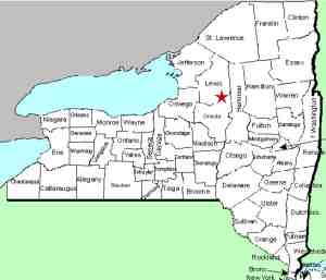
| County: |
Lewis |
| Town: |
West Turin/Lyonsdale |
| USGS Map: |
Port Leyden |
| Waterway: |
Black River |
| Latitude: |
N 43o 37'
06" |
| Longitude: |
W 75o 21' 29" |
| Drop: |
63' |
| Type: |
Rectangular Block |
| Region: |
In the village of Lyons Falls |
| Parking: |
Unpaved lot |
| Trail type: |
Dirt |
| Length of hike: |
1 minute |
| Difficulty: |
Easy |
| Accessibility: |
Public |
| Name: |
Official |
|
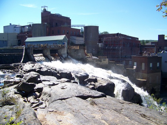
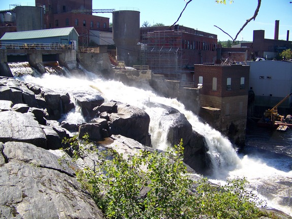
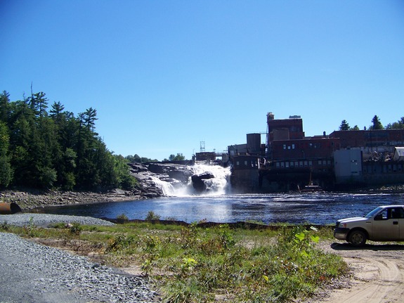
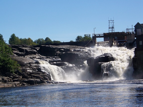
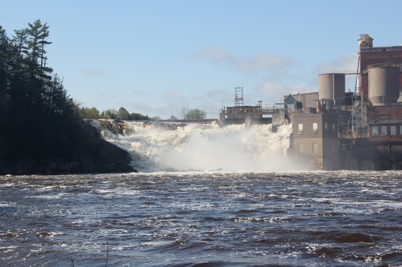
 Lyons Falls is another one of those waterfalls that has been
a power dam for many years. It is somewhat of a unique situation,
in that there is still an impressive set of falls below the dam.
Located on the Black River in the village of Lyons Falls, it is
just below where the Moose River joins the Black. Lyons Falls is another one of those waterfalls that has been
a power dam for many years. It is somewhat of a unique situation,
in that there is still an impressive set of falls below the dam.
Located on the Black River in the village of Lyons Falls, it is
just below where the Moose River joins the Black.
Over the years, this waterfall has powered various mills.
There is still a hydro-electric plant operating here but the
other facilities have fallen into a serious state of
disrepair. A short time ago, we learned that there was a
movement underway to remove the decaying structures and on our
last trip there, it appeared that this process has started.
The hamlet
and town of Lyonsdale and the village of Lyons Falls were all
named after Caleb Lyon, an early settler who served on the New
York State Assembly, first elected in 1824.
We were notified on June 14, 2017 that the Board on
Geographic Names has accepted our application and Lyons Falls is
now listed on the USGS GNIS.
The Black River empties into Lake Ontario at the Black River
Bay, just southwest of the village of Dexter.
Updated: June 14, 2017
|