| Directions
At the very southern end of Tupper Lake, Rt 421 meets
NY 30. Traffic signs at this corner will indicate "Horseshoe
Lake" and there is a DEC sign for the "Bog River
Area". In about 0.6 miles, this road will take
a bend to the left and you will cross a small bridge.
There is a little turn-off/parking area just past the bridge
on the left.
|
| County: |
St. Lawrence |
| Town: |
Piercefield |
| USGS Map: |
Piercefield |
| Waterway: |
Bog River |
| Latitude: |
N 44o 07' 43" |
| Longitude: |
W 74o 32' 42" |
| Drop: |
30' |
| Type: |
Segmented |
| Region: |
NY 30 between Tupper Lake and Long Lake |
| Parking: |
Unpaved lot |
| Trail type: |
Dirt/roadside |
| Length of hike: |
Less than 1 minute |
| Difficulty: |
Easy |
| Accessibility: |
Public |
| Name: |
Official |
|
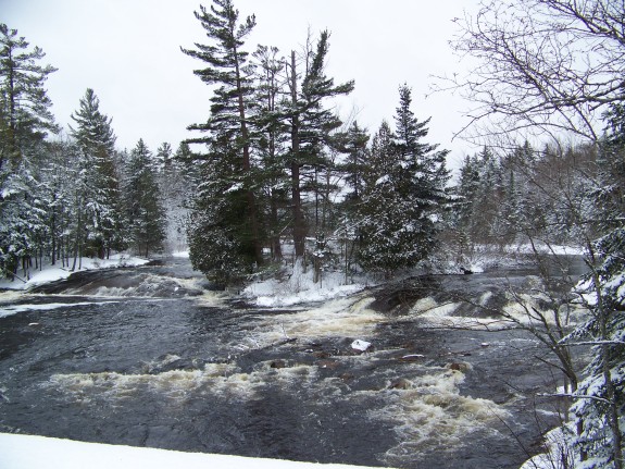
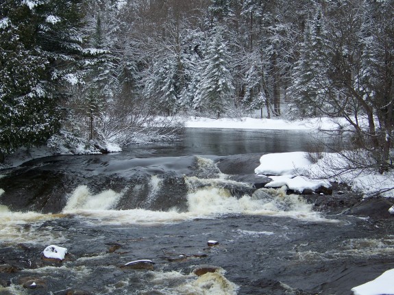
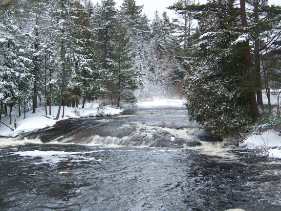
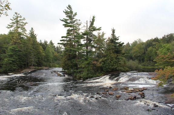
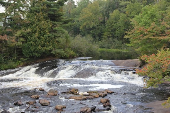
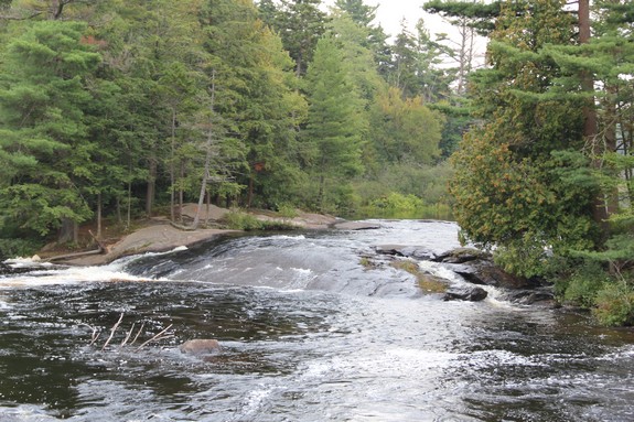
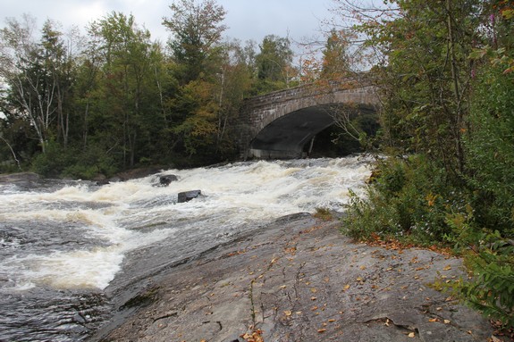
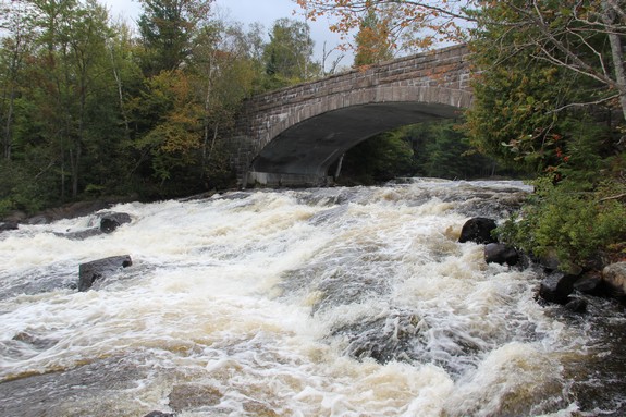
 These falls are somewhat unique. Most waterfalls are on
a river or stream somewhere upstream of the outlet. The Bog
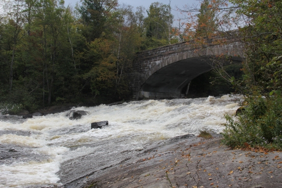
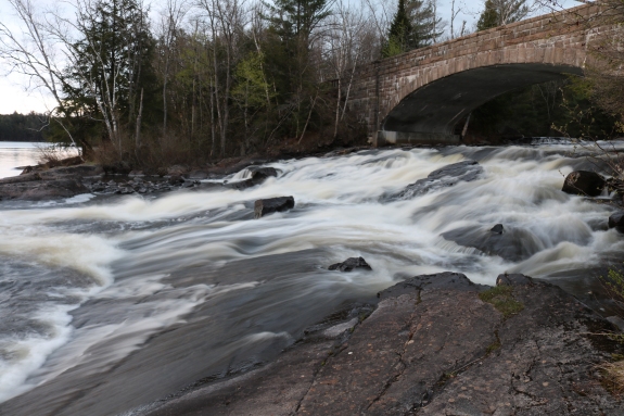
River Falls are comprised of an upper and lower part, with the lower
part dropping directly into Tupper Lake. The upper part is
estimated to be just under 8' and is split around a small island
just upstream from this bridge. The lower part accounts for
the remainder of the 30' drop and is right under the bridge. These falls are somewhat unique. Most waterfalls are on
a river or stream somewhere upstream of the outlet. The Bog
River Falls are comprised of an upper and lower part, with the lower
part dropping directly into Tupper Lake. The upper part is
estimated to be just under 8' and is split around a small island
just upstream from this bridge. The lower part accounts for
the remainder of the 30' drop and is right under the bridge.
Another interesting bit about these falls are that they are in
St. Lawrence County, as is Route 421 and its intersection with NY
30. The majority of route 30 in this area, however, is in Franklin County.
Although there are no signs in either direction, the county line
does cross Route 30 at two places, about 1/4 mile from the
intersection in both directions. Other than restricted private roads and trails,
there is no outlet to Route 421, which means that most people can't
get to this part of St. Lawrence County without going through Franklin
County, unless it is done by boat.
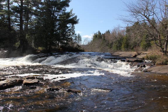
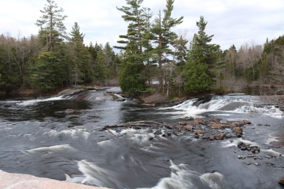
You can easily access the crest of the falls by heading to the
shore behind the parking area. Across the road from the parking
area, there is a trail leading to the lake shore where there are
better views of the bottom. There are a number of picnic tables
available near the parking lot and on the other side of the bridge.
There are signs indicating that overnight camping is not permitted.
To do justice to both sections of the area, we have included
two videos, one of each drop.
Another bit of interesting information about this location is
the name of the waterway. During the review of our application
to have Bog River Falls officially named, it was discovered that
the waterfall wasn't on the Bog River! This is one of those,
"how did this happen" moments. The source of Bog River is eleven
miles or so away in the area of Bog Lake and Lows Lake. A
mile-and-a-half upstream from the waterfall, a two-mile long
stream joins Bog River. This waterway, formerly called Round
Lake Stream, drains Round Lake. Back in the 1980s, for reasons
no one really can explain, the decision was made that Bog River
ended at this junction, and the entire distance from Round Lake
to the waterfall became Round Lake Outlet. This meant that Bog
River Falls has actually been on Round Lake Outlet for the past
35 years or so. Town of Piercefield officials were contacted for
their input. This was a surprise to them because locally this
was still known as Bog River. At the February 8, 2018 meeting of
the BGN, this situation was returned to its original state. Bog
River Falls is once again on the Bog River!
The name of this waterfall and the
name of this stretch of river became official on February 8,
2018.
The Bog River flows into Tupper Lake, which feeds the Raquette
River. The Raquette flows into the St. Lawrence River in Massena,
New York.
Last update: February 24, 2018
|