| Directions
From I-87 exit 30, take US 9 north. About
1-1/4 mile past the 9/73 intersection, there is a bridge
over the Boquet River. You will see the river as you
approach this area. You will want to park before crossing
the river.
|
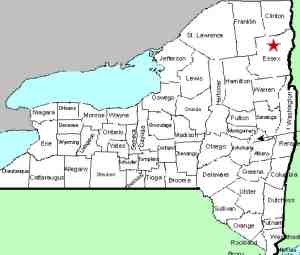
| County: |
Essex |
| Town: |
Keene |
| USGS Map: |
Keene |
| Waterway: |
Boquet River, North Fork |
| Latitude: |
N 44°
06' 37" |
| Longitude: |
W 73° 43'
08" |
| Drop: |
40' |
| Type: |
Slide with a couple of cascades |
| Region: |
NY 73 between Keene and I-87 |
| Parking: |
Unpaved lot |
| Trail type: |
Dirt |
| Length of hike: |
3/4 mile, one-way |
| Difficulty: |
Easy |
| Accessibility: |
Public |
| Name: |
Unnamed |
|
The parking area for this waterfall
is actually the same point for the
Boquet River Route 73 Falls.
There is roadside shoulder parking on both sides of the road and
on both sides of the bridge. Most people will opt to park
there. There is also a parking area on the I-87 side of the
bridge on the upstream side of the road. The road leading
in to this is extremely rutted and bumpy so it would only be advisable
to try this with a four-wheel drive vehicle, or at least a vehicle
with adequate clearance. We're not saying you won't make it
in the family sedan, you just might not want to try it.
The trailhead starts at the parking lot. Although not well
marked, it is well-worn. Follow it upstream. This
is a moderate hike of about 3/4 mile one-way and worth every step.
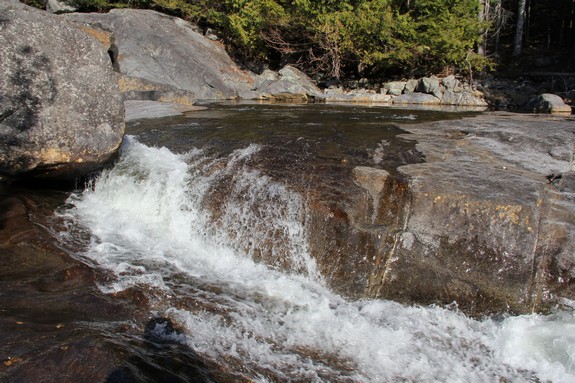
This is a very pretty location. This entire stretch of the
river is one continuous drop after another. There are dozens
of one to two foot drops all along the way. About 1/2 mile
in, you will come to a large boulder on the riverbank. The
option is there to climb the steep embankment and take the high
road but we would advise that you stay on the river's edge.
It is a much easier route. This is assuming of course that
you are not there during the spring run-off. At the right
time of year, you might have to stay inland to avoid the heavy flow.
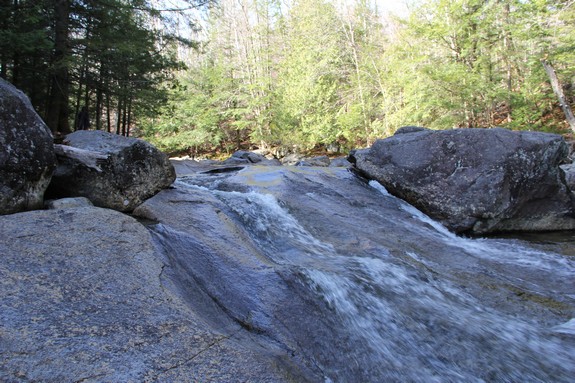
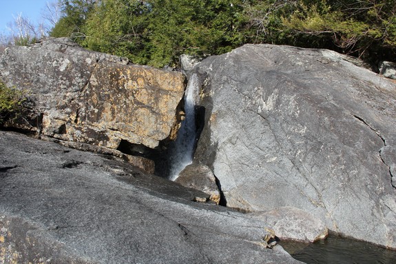
The top of the falls is a broad rock slide about 40 feet long
emptying into a narrow channel. A short distance down there
is a drop of about three feet before coming to a pool about 30 feet
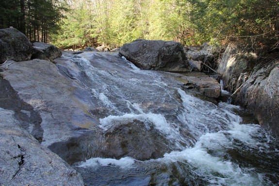
wide by 20 feet long. At the bottom of this, it drops another
two feet and then narrows to a channel only a foot or two wide before
narrowing into a crevice worn in the rock. At this point,
it takes a head-long drop through a very narrow opening between
two huge boulders. There is a 15 to 20 foot drop at that point.
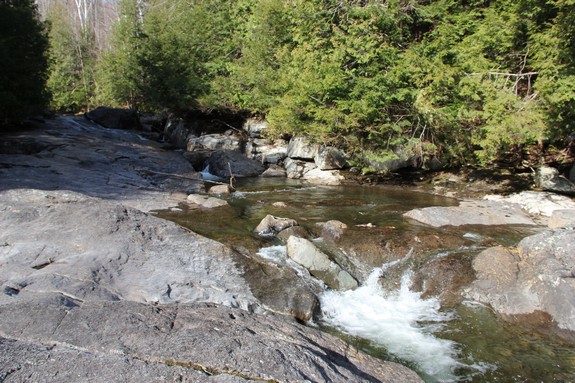
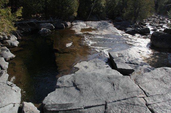
There are large expanses of flat rock in this area with a couple
of small cascades before the stream finally levels out for its journey
onward.
With the hike to this area and the bountiful rocks and ledges,
this would be an ideal spot to rest and have your lunch, or at least
a snack.
The North Fork of the Boquet River joins the south fork just
downstream from here, shortly before the routes 73 and 9 interchange.
The Boquet then flows into Lake Champlain near Willsboro, New York.
Last update: July 30, 2019
|