| Directions
As you travel west on US 11 in the village of Chateaugay,
you will cross the Chateaugay River. The first left
after the bridge is Franklin County Route 22. Almost
immediately after turning on this road, the first left is
Cemetery Road. This will end at a "T". Take
another left and you will come to the entrance of High Falls
Park on the left.
|
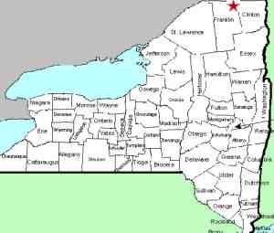
| County: |
Franklin |
| Town: |
Chateaugay |
| USGS Map: |
Chateaugay |
| Waterway: |
Chateaugay River |
| Latitude: |
N 44o 54' 34" |
| Longitude: |
W 74o 05' 11" |
| Drop: |
120' |
| Type: |
Ribbon cascade |
| Region: |
Southeast of the village of Chateaugay |
| Parking: |
Dirt lot |
| Trail type: |
Dirt, wooden and stone steps |
| Length of hike: |
0.2 miles |
| Difficulty: |
Moderate to vigorous |
| Accessibility: |
Business |
| Name: |
Official |
|
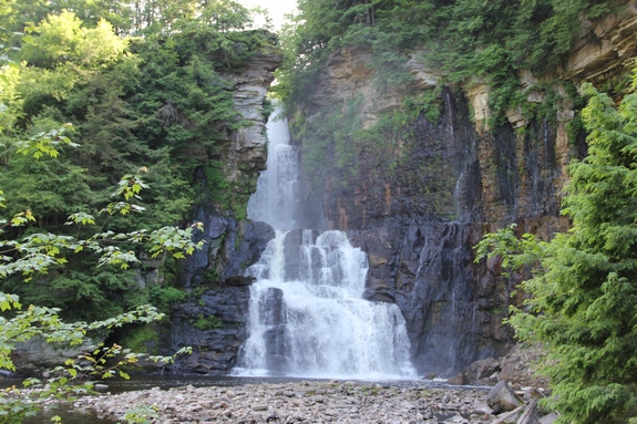
 One of the many High Falls in northern
New York, this one is quite impressive. One of the many High Falls in northern
New York, this one is quite impressive.
To access the waterfall, you must enter through the park store,
which is at the end of a short entrance drive. There is a
modest charge of $3 for adults (in 2017), $2 for students and age
55 and over. This is up a dollar a pop since our last
visit in 2011. Although many waterfall lovers would rather see
falls in the wilds, the charge at this privately run campground
is very reasonable and well worth it. As a private facility,
it is only operated seasonally. They are only open May 1 through
October 15, later if Mother Nature allows it.
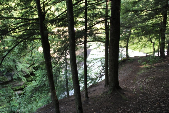
The hike to the falls is less than 2/10 of a mile, but the last
350 feet or so is a stairway to the bottom of the gorge. There
were either 208 or 209 steps, depending who in our party was counting,
comprised of a combination of wooden and natural stone steps.
The walk down wasn't bad, but coming back up could wind the less
agile! Considering the convenience of these steps, you will
appreciate the modest admission charge. This would be one
difficult trek without them.
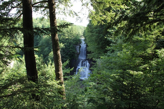
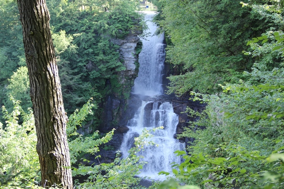
Made up of four steps, this 120' cascade is nothing short of
beautiful. The best views of it are from the base but you
can also access it on an upper trail and see the dam above it and
the top of the falls.
A note of clarification ... There are only a few public Adirondack
locations that we know of where you will have to pay an admission
to see the waterfalls. This is one of a couple of others where
you have to pay, but it is not within the Adirondack Park boundary.
The Chateaugay River flows north and crosses the NY-Canadian
border just a few miles downstream from this site. It then
empties into the St. Lawrence River near Montreal.
The Chateaugay is actually one of the smaller rivers in northern
New York. Its source is just a few miles upstream where numerous
streams feed the Upper Chateaugay Lake, just across the line in
neighboring Clinton County. The water then flows into a river-like
area known as the Chateaugay Narrows and then into the Lower Chateaugay
Lake before the Chateaugay River officially begins in Franklin County.
Generally flowing north after leaving High Falls, the Chateaugay
enters the Canadian province of Quebec, where this French speaking
region knows it as the Châteauguay. The distance from the
source to High Falls is roughly the same as the distance from High
Falls to the Canadian border. If you take the Narrows and
two lakes out of the equation, there is slightly more to this river
in Canada than there is in the United States.
Last update: August 18, 2017
|