| Directions
We are looking into the public accessibility of this
waterfall.
|
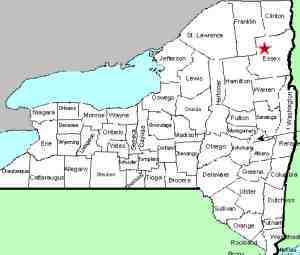
| County: |
Essex |
| Town: |
Newcomb |
| USGS Map: |
Santanoni Peak |
| Waterway: |
Cold River |
| Latitude: |
N 44o 6' 21" |
| Longitude: |
W 74o 12' 34" |
| Drop: |
NA |
| Type: |
NA |
| Region: |
NY 28N between Long Lake and Newcomb |
| Parking: |
NA |
| Trail type: |
NA |
| Length of hike: |
NA |
| Difficulty: |
NA |
| Accessibility: |
Private |
| Name: |
official |
|
West of the hamlet of Newcomb, there is a road that heads north
to Arbutus Pond. Millers Falls is about 9.5 miles, as the
crow flies, from that intersection.
The roads leading into this area are labeled on maps as private
and signs at the intersection of NY 28N indicate that they are private.
There are also a number of posted signs on both sides of the road
at this point. This waterfall is extremely remote but it is
probably within sight of the Northville Placid Trail. This would
be a significant hike but could be done. We are continuing
to research this.
If anyone has any information about these waterfalls, we would
be very interested in
hearing from you.
The Cold River dumps into the Raquette River just above Long
Lake.
Last update: August 9, 2015
|


