| Directions
Take NY 26 south from West Carthage to the hamlet of
Deer River. These falls will be on the upstream
side as you
cross the bridge over the river.
|
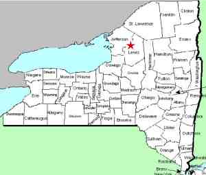
| County: |
Lewis |
| Town: |
Denmark |
| USGS Map: |
Carthage |
| Waterway: |
Deer River |
| Latitude: |
N 43o 55' 51" |
| Longitude: |
W 75o 35' 27" |
| Drop: |
~ 15' |
| Type: |
Rectangular Block |
| Region: |
South of Carthage |
| Parking: |
Roadside |
| Trail type: |
Roadside |
| Length of hike: |
Roadside |
| Difficulty: |
Easy |
| Accessibility: |
Public |
| Name: |
Common |
|
 One of the many small, unnamed falls in northern
New York, these falls are on the Deer River in the hamlet of Deer
River and can be easily seen from the bridge there on Route 26. One of the many small, unnamed falls in northern
New York, these falls are on the Deer River in the hamlet of Deer
River and can be easily seen from the bridge there on Route 26.
The last photograph in this display is a copy of an old postcard
of these falls. This came from the collection of Scott A.
Ensminger of
falzguy.com. Notice this shows a dam and mill that previously
existed just above the falls. These were removed several decades
ago.
The Deer River flows to the Black River which empties into Lake
Ontario at the Black River Bay, just southwest of the village of
Dexter.
Last update: June 12, 2017
|


