| Directions
This waterfall may best be accessed by canoe.
|
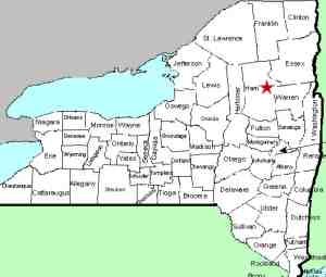
| County: |
Hamilton |
| Town: |
Lake Pleasant |
| USGS Map: |
Page Mountain |
| Waterway: |
Dug Mountain Brook |
| Latitude: |
N 43o 35' 45" |
| Longitude: |
W 74o 23' 29" |
| Drop: |
NA |
| Type: |
NA |
| Region: |
NY 30 south of the hamlet of Indian Lake |
| Parking: |
NA |
| Trail type: |
NA |
| Length of hike: |
NA |
| Difficulty: |
NA |
| Accessibility: |
Public |
| Name: |
Unnamed |
|
This waterfall is near where the Dug Mountain Brook ends at the
Jessup River. our information is that it is best accessed
by canoe, a 7.0 mile paddle, one-way! Contour maps do show
a hiking trail in the general area. The trail is only 1.3
miles long, but it stops short of the waterfall by about 300 yards.
That is not a long distance, but we do not have any information
on the last part of this route.
We have also found information on-line that indicates that "the
falls are about a half mile east of the trailhead located on the
northern bank of Dug Mountain Brook." We are following
up on this but it is misleading to us. First of all, none
of our maps show a trail on the northern bank of the brook.
Secondly, our information is that the falls are less than 100 feet
from where the brook ends at the Jessup River. Since this
point is east of the Jessup River, we aren't sure how the falls
can be 1/2 mile east of the trailhead. That would put the
trail on the west side of the Jessup. It doesn't make sense!
If anyone has any information about these waterfalls, we would
be very interested in
hearing from you.
Dug Mountain Brook dumps into the Jessup River. This river
flows north into the Indian Lake, through an area known as The Narrows
and into the Indian River before reaching Lake Abanakee. This
lake feeds another stretch of the Indian River. Despite all
of this northerly flow, this water eventually reaches the Hudson
River, which flows east for a stretch before turning south for its
journey to the Atlantic ocean.
Last update: August 10, 2015
|


