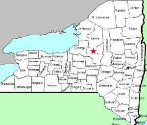
| Directions
Follow NY 69 east from Camden to Taberg. Shortly
after crossing the Fish Creek East Branch in Tabert, take
a right on the Coal Hill Road. A hundred yards or
so after passing the end of the Slater Road, park on the
right side of the road.
|
| County: |
Oneida |
| Town: |
Annsville |
| USGS Map: |
Lee Center |
| Waterway: |
Fall Brook |
| Latitude: |
N 43o 20' 53" |
| Longitude: |
W 75o 35' 1" |
| Drop: |
NA |
| Width: |
NA |
| Region: |
Northeast of Rome |
| Parking: |
Roadside |
| Trail type: |
Dirt |
| Length of hike: |
NA |
| Difficulty: |
NA |
| Accessibility: |
Public |
| Name: |
Unnamed |

|
Please note that this is private
property. The land owner has allowed access, but will close
this down if there becomes any misuse. You should be able
to find an opening to the field on your right. Walk at a right
angle from the road to the line of trees at the back of the field.
When you get to the wood line, bear right and follow it until you
get almost to the end of the field. There will be a well-worn
path to the left that leads into the woods. Follow it and
you will see several falls along the way.
When we were there, although we were prepared for walking, we
weren't prepared for rappelling! We may be exaggerating somewhat,
but the drop-off into the ravine containing these falls is steep.
You can easily get close enough for pictures of the top several
cascades, but the lower ones would be a challenge. Some of
these falls are used by the locals for swimming so it is possible
to get down and back up from them. We decided that without
ropes to facilitate our return from the bottom, we would be satisfied
with pictures from the top. Some of our pictures were contributed
by younger photographers who have made the descent. As one
of the pictures demonstrates, they used ropes.
We originally had this site posted as Fall Brook Falls, based
on the waterway containing it. Subsequently, we have been
told that it is known locally as Five Falls, which undoubtedly
came from the number of drops at this point.
The Fall Brook empties into the East Branch of the Fish Creek
within site of the last cascade. The water then flows into
the Fish Creek which empties into the Erie Canal just east of Oneida
Lake at Sylvan Beach. Then the water flows through Oneida
Lake and into the Oneida River where it joins forces with the Seneca
River in Three Rivers, a community in Clay, New York, just northwest
of Syracuse. This forms the Oswego River, which empties into
Lake Ontario in the city of Oswego.
Last update: April 19, 2019
|


