| Directions
This location uses the same trailhead as Copper Rock
Falls. It is 8.9 miles from the north end of the Tooley Pond Road
and 8.4 miles from the southern end.
|
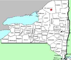
| County: |
St. Lawrence |
| Town: |
Clare |
| USGS Map: |
Tooley Pond |
| Waterway: |
Grass River South Branch |
| Latitude: |
N 44o 17' 24" |
| Longitude: |
W 74o 57' 22" |
| Drop: |
12' |
| Type: |
Cascade |
| Region: |
South of Canton |
| Parking: |
Roadside |
| Trail type: |
Dirt |
| Length of hike: |
1.0 mile |
| Difficulty: |
Moderate |
| Accessibility: |
Public |
| Name: |
Unnamed |
|
This unnamed waterfall is the uppermost of three drops in fairly
close proximity of each other. You will encounter
Copper Rock Falls and
Copper Rock Upper Falls #1
on your way to this one.
The Grass River flows into the St. Lawrence River in Massena,
in St. Lawrence County.
Last update: August 5, 2021
|


