|
 Twin Falls is one of eight well-known waterfalls on the South
Branch of the Grass River which are fairly easy to access from
the Tooley Pond Road. This road connects CR 27 in the hamlet of Degrasse to NY
3 near Cranberry Lake. Like many of the falls on this road,
it is on DEC maintained state land, accessible to the public.
It is also possible to reach this location from the Route 3 end
but our information details access from the north. Twin Falls is one of eight well-known waterfalls on the South
Branch of the Grass River which are fairly easy to access from
the Tooley Pond Road. This road connects CR 27 in the hamlet of Degrasse to NY
3 near Cranberry Lake. Like many of the falls on this road,
it is on DEC maintained state land, accessible to the public.
It is also possible to reach this location from the Route 3 end
but our information details access from the north.
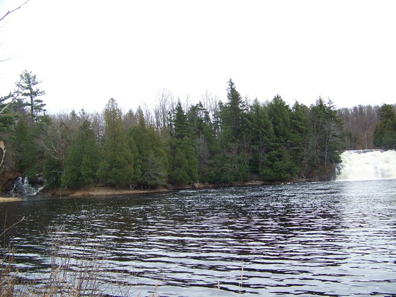
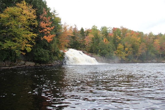
If you are visiting the Tooley Pond Road falls in order, it is
about one mile past Sinclair Falls. The river is flowing in
a generally east-west direction at this point. An island separates
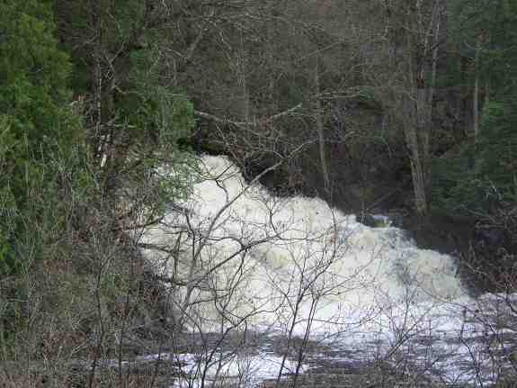
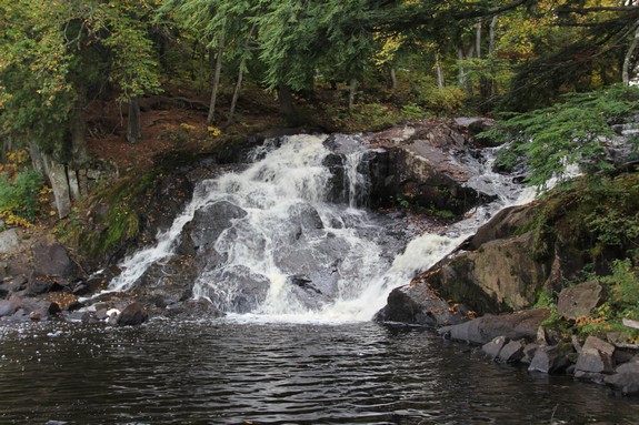
the river with the north channel terminating in the smaller waterfall.
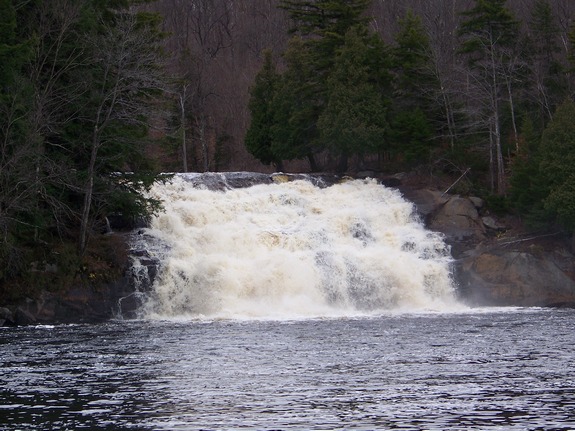
The southern channel ends with a very nice 55' drop that is close
to 100' feet wide.
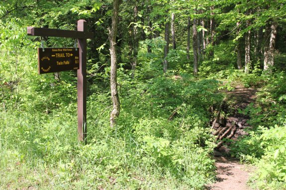
We would like to commend the staff at DEC. They have done some
work on the trails to the waterfalls in this area. There now a
sign at the trail-head identifying this waterfall. The sign
notes that the hike is 0.1 mile. They have also laid
stones across the small channel to facilitate accessing the
island. We suspect that you may still get your feet wet if
you try this during heavy spring run-off.
You can see the smaller falls from the road. To see the
larger span, cross to the island. Once on the island, you
can bear right and find your way to the smaller waterfall.
After enjoying this side, continue around the island and
you will be greeted by the larger cascade.
Your views, although not directly below it, are
unobstructed. You
can also hike a bit further and reach its crest.
To see both parts together you need to be downstream. This
has to be done in a kayak or canoe. There is a dirt road just
before the falls giving access to the point of land just below the
falls where you get a good view of both falls. However, this
is private land and it is posted. According to the posted
signs, the owner lived a short distance away on an adjoining road
that was only about a mile or so away so I went for a drive.
I found the owner and explained what I was doing. He was very
cordial and granted it. As it turns out, he is the father
of a former student of mine. As always, please honor the landowners'
rights.
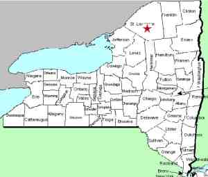
The Grass River flows into the St. Lawrence River in Massena,
in St. Lawrence County.
Note: Depending upon which map or sign you are using, this
river is referred to as either Grasse or Grass. Officially
it is Grass.
Another note: We have found an on-line source that identifies
the large side of this waterfall as Twin Falls and the other side
as one of the other Tooley Pond Road waterfalls. Be assured
that these two comprise the Twin Falls.
Last update: June 5, 2021
|