| Directions
From Harrisville: Proceed east on NY 3 through
the hamlet of Pitcairn. Past this, you will go by
the end of St. Lawrence County Route 23 on your left.
The Greenwood Road is exactly one mile past this intersection.
From Star Lake: Coming from the east on NY 3, you
will come by the end of New York State Route 58. A
short distance later, you will cross what is know locally
as the "Blue Line". This is the boundary
of the Adirondack Forest area. The Greenwood Road
is the first left as you leave the Adirondacks.
|
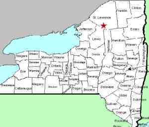
| County: |
St. Lawrence |
| Town: |
Pitcairn |
| USGS Map: |
Fine |
| Waterway: |
Greenwood Creek |
| Latitude: |
N 44° 12' 18" |
| Longitude: |
W 75° 11' 44" |
| Drop: |
58' |
| Type: |
Ribbon Cascade |
| Region: |
Off NY 3 between Harrisville and Fine |
| Parking: |
Unpaved lot |
| Trail type: |
Dirt |
| Length of hike: |
0.1 mile |
| Difficulty: |
Easy |
| Accessibility: |
Public |
| Name: |
Official |
|
 Although this is technically
not a named waterfall and isn't indicated on topographical maps,
this is a popular spot locally and is known as Greenwood Falls.
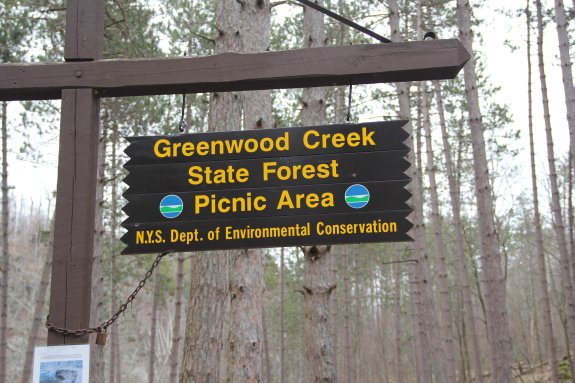
They are located in the Greenwood Creek State Park Picnic Area.
This is easily found off New York State Route 3, just east of Harrisville. Although this is technically
not a named waterfall and isn't indicated on topographical maps,
this is a popular spot locally and is known as Greenwood Falls.
They are located in the Greenwood Creek State Park Picnic Area.
This is easily found off New York State Route 3, just east of Harrisville.
There is a sign on the end of this road that says "Greenwood
Creek State Park Picnic Area 1 mile". Actually, it is
1.2 miles down this dirt road. There is a family home just
in from the corner. Beyond that, all you will see are hunting
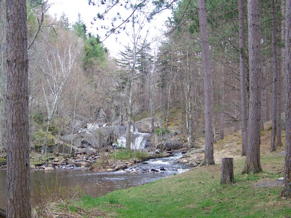
and other small camps. The falls are at the back of the picnic
area, which is very nicely maintained by the NYS Department of Environmental
Conservation. There are several picnic sites with tables and
fireplaces. There are also a number of designated campsites
where you can stay for up to three nights at no charge. This
is a first-come, first served situation.
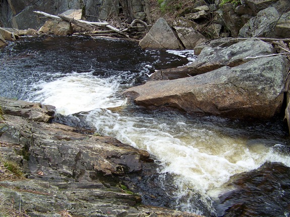
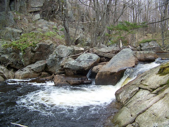
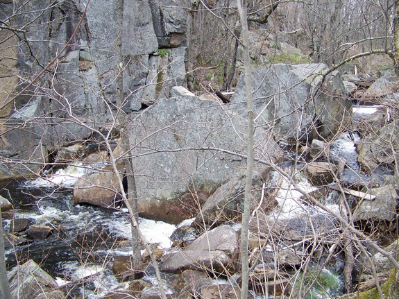
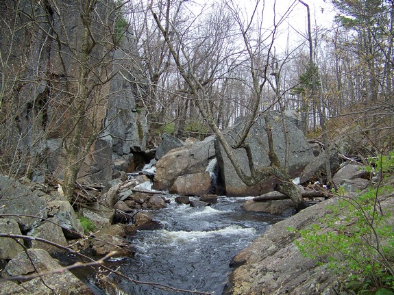
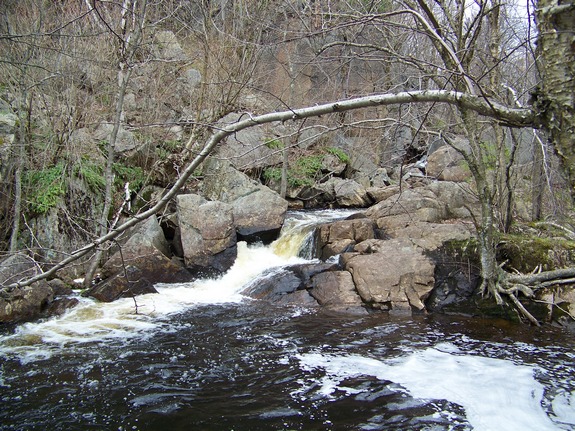
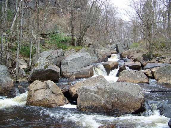
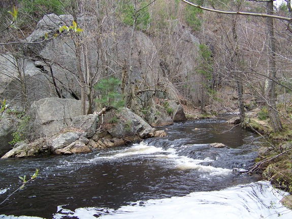
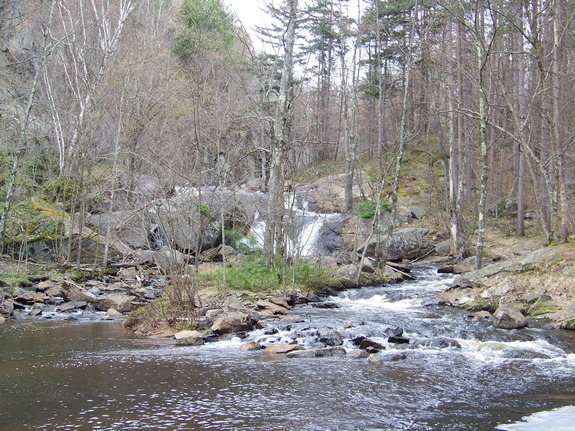
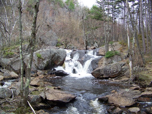
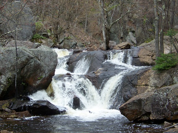
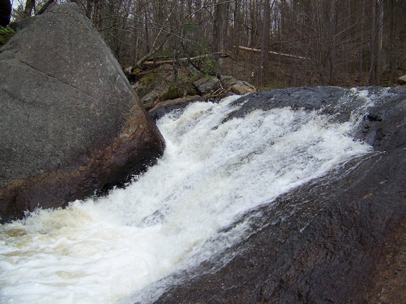
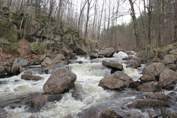
Greenwood Falls is actually a series of drops on this creek,
totally an estimated 50 or 60 feet. Above the falls, the Greenwood
Creek is a calm stream. As the channel narrows, it drops a
foot or two and takes a 90° turn to the left. From here, it
takes 5 or 6 drops of 3 to 5 feet each over the next 120 or so feet
of the creek. The channel levels out for a short distance
and into a right turn and the main drop. This drop is 5 or
6 steps of about 15' in overall drop. At the bottom, in the
picnic area, there is a shallow pool which leads to another small
drop just below the picnic area.
The hike to the top of this area is over a trail of moderate
difficulty. This would be a nice area for a family outing.
The hike isn't so extreme as to frustrate less experienced hikers
and the time needed to traverse the distance is short. You
can be at the top in five minutes or so. In addition, the
picnic area provides a nice spot for lunch and a little relaxing.
Although this waterfall is just outside the Adirondack Blue Line,
you have the atmosphere of the forest all around you.
The name of this waterfall is now official, having been added
to the GNIS data base on November 9, 2017.
Greenwood Creek flows into the Big Creek which flows into the
West Branch of the Oswegathchie River. This joins the main
channel of the Oswegatchie near the hamlet of Talcville in the town
of Edwards. From here it flows into the St. Lawrence River
in Ogdensburg.
Last update: November 14, 2017
|