| Directions
This area may only be accessible by water or through
private property.
|
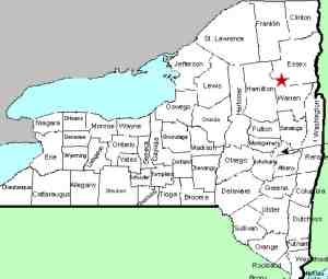
| County: |
Hamilton/Essex |
| Town: |
Minerva |
| USGS Map: |
Dutton Mt |
| Waterway: |
Hudson River |
| Latitude: |
N 43o 48' 19" |
| Longitude: |
W 74o 04' 45" |
| Drop: |
NA |
| Type: |
Rapids |
| Region: |
Essex/Hamilton County line |
| Parking: |
NA |
| Trail type: |
NA |
| Length of hike: |
NA |
| Difficulty: |
NA |
| Accessibility: |
Unknown |
| Name: |
Common |
|
This is a named stretch of rapids on the Hudson
River, about mid-way between of where the Boreas River and the oK
Slip Brook enter. We are attempting to determine whether it
is publicly accessible via a land route.
If anyone has pictures or information on this area, please
contact us.
The Hudson River empties into the Atlantic ocean in New York
City.
Last update: october 19, 2015
|


