| Directions
From Lowville, take the Number Four Road to the hamlet
of Bushes Landing where you will pick up the Pine Grove
Road. Proceed past the intersections of the Austin
Road and the Bradish Road and you will come to the Rudd
Road on your left. Actually, the Rudd Road is a loop
and the other end is just past the bridge over the Independence
River, a short distance down the road.
|
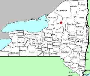
| County: |
Lewis |
| Town: |
Greig |
| USGS Map: |
Brantingham |
| Waterway: |
Independence River |
| Latitude: |
N 43° 43' 56" |
| Longitude: |
W 75° 21' 41" |
| Drop: |
~50' |
| Type: |
Multiple drops |
| Region: |
Southeast of Lowville |
| Parking: |
Roadside |
| Trail type: |
Roadside |
| Length of hike: |
Roadside |
| Difficulty: |
Easy |
| Accessibility: |
Private |
| Name: |
Common |
|
 This location isn't especially remote,
but it is a few miles from any community of any size. Although
this road is a loop, you can't get there from here! At least,
not in a car or truck. The bridge, about half-way down this
road is closed. We presume that it reached a point where significant
maintenance was needed and the lack of traffic didn't warrant the
expense. There are dirt/sand piles on both ends but pedestrian
traffic is still possible. We came in from the southern end,
which was a short distance and easily passable. Since we didn't
drive the other end, we can't make any statements about its condition. This location isn't especially remote,
but it is a few miles from any community of any size. Although
this road is a loop, you can't get there from here! At least,
not in a car or truck. The bridge, about half-way down this
road is closed. We presume that it reached a point where significant
maintenance was needed and the lack of traffic didn't warrant the
expense. There are dirt/sand piles on both ends but pedestrian
traffic is still possible. We came in from the southern end,
which was a short distance and easily passable. Since we didn't
drive the other end, we can't make any statements about its condition.
For the first two years after learning of this location, we had
it posted as Rudd Road Falls due to its location. In September
2013, we had the opportunity to meet a couple that grew up in that
area and they told us that locally, this is known as Hidden Falls.
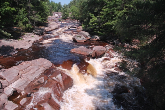
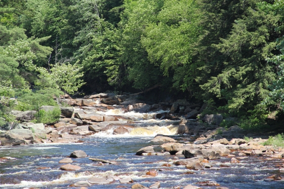
This is a very interesting area. There is about a six to
eight foot drop at the bottom by the bridge and another drop of
about the same size a quarter mile or so upstream. Between
these is a series of drops and slides over mostly smooth rock that
has been worn over the centuries. These slides continue
downstream of the bridge and you can see the bottom drop from
the bridge on Pine Grove Road.
Please understand that the land surrounding the river here is
private, and much of it is posted. Physically, the river
bed here would easily allow you access to hike up it. We
have not checked into the legality of that so it is not
something we will promote.
The Independence River flows into the Black River just a few
miles downstream from this location in the town of Watson.
The Black empties into Lake Ontario in the Jefferson County community
of Dexter.
Last update: June 13, 2017
|