| Directions
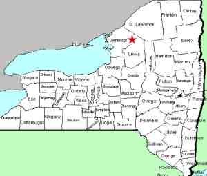
To get here, locate Natural Bridge on NY 3, between Carthage
and Harrisville. There are four streets in the hamlet
which take you south off Route 3. Depot Street is
the east-most of these. As you proceed out of the
hamlet, the road will curve and you will come to an intersection.
The North Croghan Road will be on your right and the Slye
Road on your left. These falls are to the east and
north of this intersection.
|
| County: |
Jefferson |
| Town: |
Wilna |
| USGS Map: |
Natural Bridge |
| Waterway: |
Indian River |
| Latitude: |
N 44° 04' 02" |
| Longitude: |
W 75° 29' 27" |
| Drop: |
25' |
| Type: |
Various |
| Region: |
Between Carthage and Harrisville |
| Parking: |
Roadside |
| Trail type: |
Dirt/rock |
| Length of hike: |
2 minutes |
| Difficulty: |
Easy |
| Accessibility: |
Private |
| Name: |
Unnamed |
|
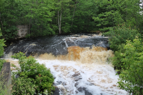
 The
Natural Bridge Falls are actually an unnamed group of waterfalls
located on the Indian River just outside the hamlet of Natural
Bridge. Depending upon who is counting, there are four or five
waterfalls here. One of the easiest to see is just upstream from the bridge
east of the intersection. Walk a few hundred feet up the Slye
Road and you will see it on your right. To distinguish these
falls, we will call this one the Natural Bridge Upper Left Falls.
It is about an 8 foot drop. Depending upon the amount of
water flowing, it may be possible to descend the bank and get
under the bridge for a river-level view of this drop. This
can be viewed in our first video. The
Natural Bridge Falls are actually an unnamed group of waterfalls
located on the Indian River just outside the hamlet of Natural
Bridge. Depending upon who is counting, there are four or five
waterfalls here. One of the easiest to see is just upstream from the bridge
east of the intersection. Walk a few hundred feet up the Slye
Road and you will see it on your right. To distinguish these
falls, we will call this one the Natural Bridge Upper Left Falls.
It is about an 8 foot drop. Depending upon the amount of
water flowing, it may be possible to descend the bank and get
under the bridge for a river-level view of this drop. This
can be viewed in our first video.
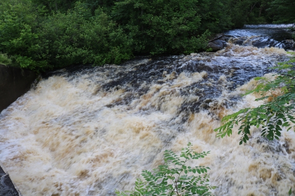
There is an island on your left as you view upstream.
Continue up the Slye Road and you will cross another bridge over
the east channel. There is another drop of about 5' in this
channel, which we will call the Natural Bridge Upper Right Falls.
This is linked to our second video. The county line runs
through this island. This drop is actually in the Lewis
County town of Diana. All the others are in Jefferson
County.
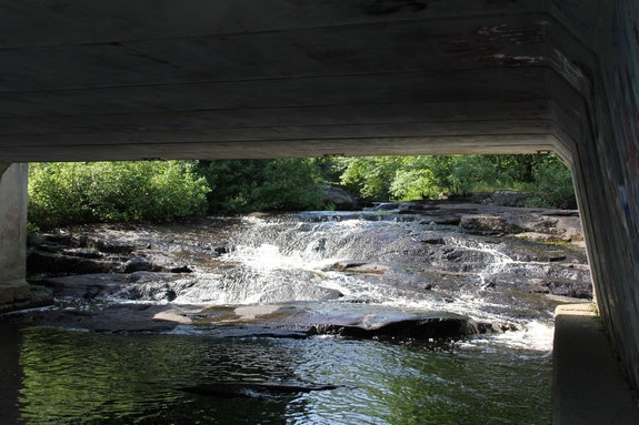
While both of the above falls are roadside views, the rest
aren't. We stress that once you are off the highway
right-of-way, you are on private property. On our first
trip there, we accompanied an NYSDEC employee who was checking
things on official business. We were with hm when we took
the remainder of our pictures.
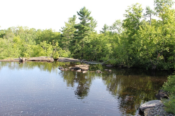
On the other side of the road there is a reservoir
of sorts. On your left as you face this there is a drop
which flows over the retaining dam. This is man-made so
might not be considered a waterfall. For the sake of
cataloging this, we'll call this Natural Bridge Reservoir Falls.
Below this, there is a cascade that parallels the road.
Views of this may be possible, but foliage may be an issue. It is an 8 to10' slide.
Since it is in the river left channel we will call this the
Lower Left Falls.
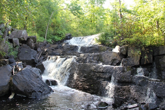
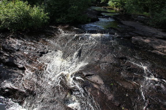
The largest drop of the group is located at the rear right of
the reservoir, downstream of the Upper Left Falls. This is a fairly
vertical drop of about three steps totalling 25'. This is a very pretty waterfall,
and the most impressive of the group so we will simply refer to as the Natural Bridge Falls.
There is somewhat of a unique situation at this site.
Often, a river serves as a boundary between counties. The
county line is at this point, but not through the river.
It runs obliquely through the island between the two upper
channels.
The Indian River continues its flow downstream through Black
Lake. Then it joins the Oswegatchie River which flows to the
St. Lawrence River in Ogdensburg.
Last update: June 28, 2017
|