| Directions
From the south: take NY 11 north from Watertown.
Just north of the village of Antwerp, your first left is
Jefferson CR 24. Take it to the end where it comes
to a "T". Take a left and you are on Jefferson
CR 25. Shortly, you will cross into St. Lawrence County
where the route number changes to SL CR 10. Almost
immediately however, SL CR 3 will be on your left.
This will take you to the hamlet of Rossie.
From the north: just south of the NY 11 bridge
in Gouverneur, take Johnstown Street, which becomes SL CR
12. This will cross into Jefferson County where the
highway becomes Jefferson CR 25 and then back into St. Lawrence
County where it becomes SL CR 10. Almost immediately
however, SL CR 3 will be on your left. This will take
you to the hamlet of Rossie.
From the west: just south of the village of Hammond
on NY 37, you will come to SL CR 3. This will take
you to the hamlet of Rossie.
|
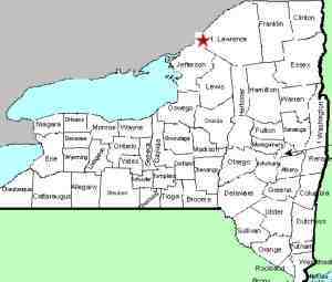
| County: |
St. Lawrence |
| Town: |
Rossie |
| USGS Map: |
Hammond |
| Waterway: |
Indian River |
| Latitude: |
N 44° 22' 50" |
| Longitude: |
W 75° 39' 08" |
| Drop: |
~15' |
| Type: |
Rectangular Cascade |
| Region: |
Northeast of Gouverneur |
| Parking: |
Unpaved lot |
| Trail type: |
Dirt |
| Length of hike: |
1 minute |
| Difficulty: |
Easy |
| Accessibility: |
Public |
| Name: |
Common |
|
 Rossie Falls is located in
the tiny St. Lawrence County hamlet of Rossie. Although Rossie
is on the Indian River, because of the way that the Oswegatchie
River winds around, Rossie's location is somewhat interesting.
If you approach it from the east, you actually have to go through
a portion of Jefferson County to get there. To get to Rossie
you need to travel a number of county roads. Since it is so
close to the county line, the directions to get there will sound
more involved than the trip will be! Because they are county
roads, the numbers will change when you cross the lines. Rossie Falls is located in
the tiny St. Lawrence County hamlet of Rossie. Although Rossie
is on the Indian River, because of the way that the Oswegatchie
River winds around, Rossie's location is somewhat interesting.
If you approach it from the east, you actually have to go through
a portion of Jefferson County to get there. To get to Rossie
you need to travel a number of county roads. Since it is so
close to the county line, the directions to get there will sound
more involved than the trip will be! Because they are county
roads, the numbers will change when you cross the lines.
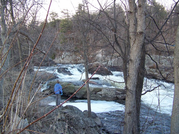
Once you are in the hamlet of Rossie, there will be a road with
a bridge over the Indian River. You can't miss it because
the end of the bridge is literally at the intersection. Cross
the bridge and the Mill Road will be on your right. There
is a parking area at the edge of the river. This waterfalls
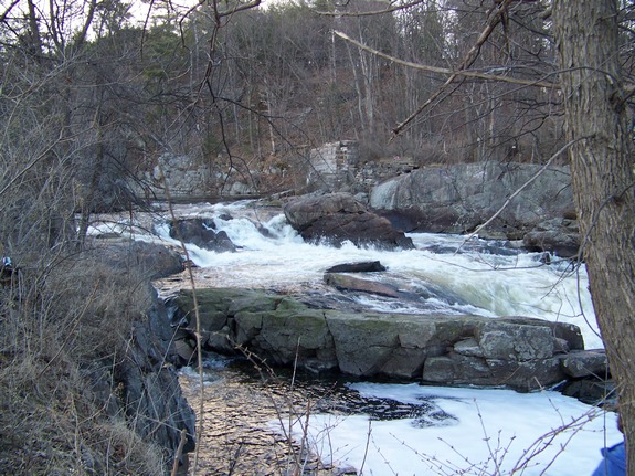
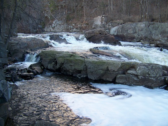
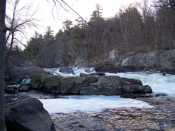
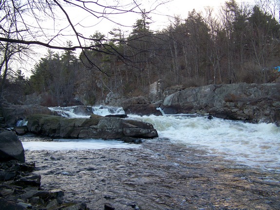
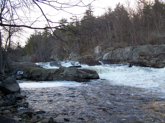
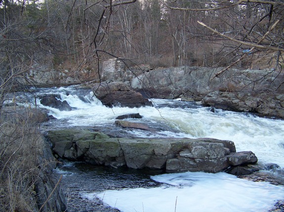
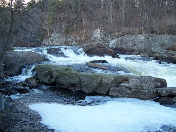
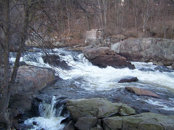
is technically unnamed but is commonly known locally as Rossie Falls.
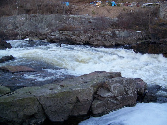
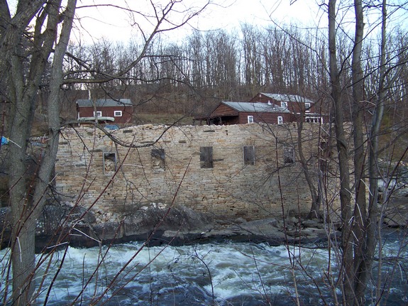
It drops in two steps, the upper is a small plunge around a couple
of good-sized boulders in the river, whereas the second drop is
more of a rapids-like slide.
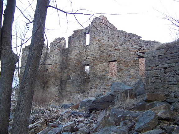
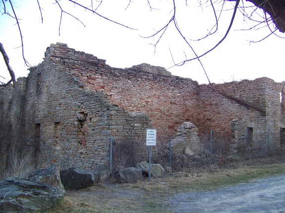
Like many falls locations, there once was a mill of some kind
here. There are remains on both sides of the river of stone
structures that are now roof-less and falling in. What is
most interesting about this location is that it is the site of an
annual natural event that is right up there with the swallows at
Capistrano. In the first week of April every year, the walleye "run"
in Rossie. Thousands of walleye return to just below the falls
to spawn. If you go during the day, you can see the fish in
the water, but the best time for viewing this is after dark with
a fairly strong flashlight. When you shine the light in the
water, the eyes of the walleye will glitter like stars.
At most times of the year, you will probably be alone when you visit
here. Just after dark during the walleye run, expect several
other vehicles to be there, including one or two NYS DEC officers.
Their presence is to assure that unscrupulous types don't try to
net the walleye.
The Indian River continues its flow downstream through Black
Lake. Then it joins the Oswegatchie River which flows to the
St. Lawrence River in Ogdensburg.
Last update: May 21, 2016
|