| Directions
Proceed on NY 12 south out of Watertown. When you
reach the hamlet of Burrville, take a right on the Plank
Road. Almost immediately, you will see the Burrville
Cider Mill on the left. The waterfall is visible from
the bridge or from the grounds of the mill.
|
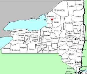
| County: |
Jefferson |
| Town: |
Watertown |
| USGS Map: |
Rutland Center |
| Waterway: |
Jacobs Creek |
| Latitude: |
N 43° 55' 48" |
| Longitude: |
W 75° 51' 33" |
| Drop: |
30' |
| Type: |
Rectangular Block |
| Region: |
Just southeast of Watertown |
| Parking: |
Paved lot |
| Trail type: |
Dirt and wooden stairs |
| Length of hike: |
2 minutes |
| Difficulty: |
Easy |
| Accessibility: |
Business |
| Name: |
Official |
|
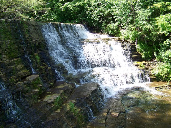
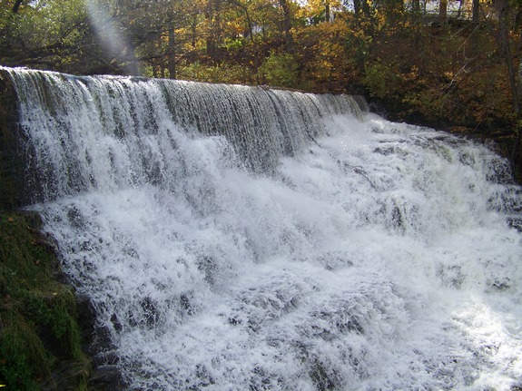
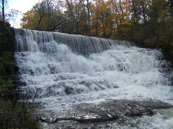
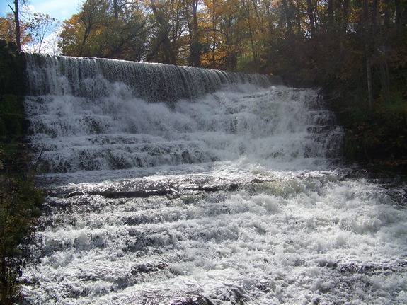
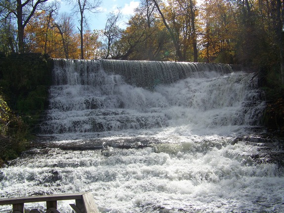
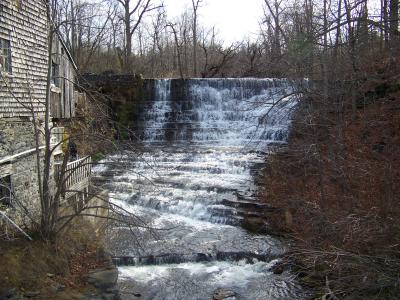
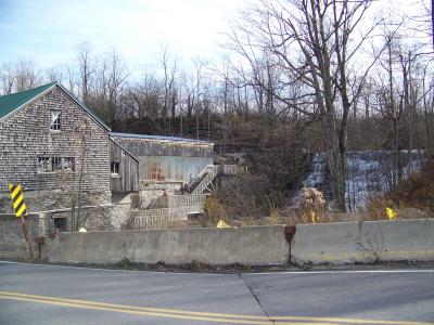
 Officially, these falls are unnamed. They are adjacent to the Burrville Cider Mill, which is a landmark
in Jefferson County. In fact, it is one of the first buildings
built in the county. Anyone in the area will tell you they
look forward each fall to visiting the cider mill where the cider
and cider doughnuts are legendary. Due to the reputation
of the cider mill, these falls are one of the two most popular falls
in Jefferson County. When the mill is producing cider between
Labor Day and Thanksgiving they are definitely the most visited
falls in the county. Officially, these falls are unnamed. They are adjacent to the Burrville Cider Mill, which is a landmark
in Jefferson County. In fact, it is one of the first buildings
built in the county. Anyone in the area will tell you they
look forward each fall to visiting the cider mill where the cider
and cider doughnuts are legendary. Due to the reputation
of the cider mill, these falls are one of the two most popular falls
in Jefferson County. When the mill is producing cider between
Labor Day and Thanksgiving they are definitely the most visited
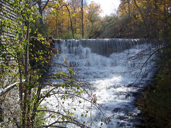
falls in the county. In addition to the two names previously mentioned, this site
has had a number of other aliases. The hamlet and this mill
were once known as Burr’s Mills, in honor of John Burr who
built the original building. As a result, they were at one
point known as Burr’s Mills Falls. Located on Jacobs
Creek, they are referred to in some documents as Jacobs Creek Falls.
This is somewhat deceiving however, because there are three other
waterfalls upstream on this waterway. They have also been
referred to as Boynton Creek Falls. That is definitely a misconception
because the Boynton Creek joins the Jacobs Creek about a quarter
mile upstream from this location. The 90' Boynton Creek Falls
is just above this junction. That waterfall, and two others
within sight of it are on private property and not available for
viewing.
We are pleased to announce that at the May 10, 2017 meeting
of the US Board on Geographic Names, the committee accepted our
proposal and this name has "been added to the Geographic Names
Information System (GNIS) and are now official for use on
Federal maps and other products."
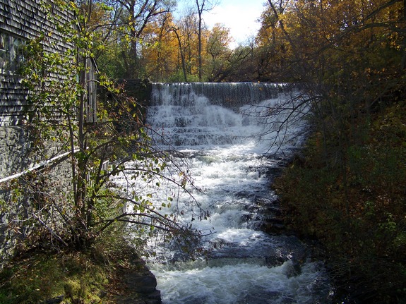
Our thanks to Greg Steiner of the Burrville Cider Mill for allowing
us access to the grounds. The Steiners encourage you to enjoy
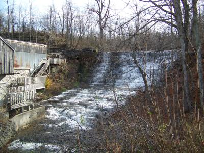
the falls when you visit the mill. They provide a viewing
platform, complete with seats and railings for your convenience.
They do ask that you not use this area during the winter months.
It is not maintained during the winter and could be treacherous
when snow-covered.
The Jacobs Creek flows into the North Branch of the Sandy Creek,
which then flows into the Sandy Creek, which eventually reaches
Lake Ontario.
Last update: October 29, 2016
|