| Directions
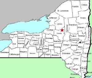
This location is on NY 46, about 2.0 miles south of
the village of Boonville. It is on private
property.
|
| County: |
Oneida |
| Town: |
Boonville |
| USGS Map: |
Boonville |
| Waterway: |
A feeder of Lansing Kill |
| Latitude: |
N 43° 27' 27" |
| Longitude: |
W 75° 18' 55" |
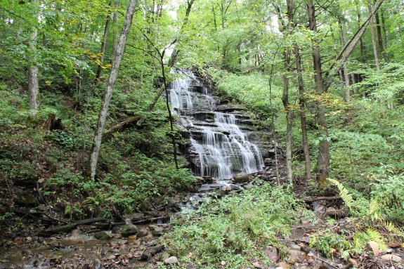
| Drop: |
50'-60' |
| Type: |
Ribbon cascade |
| Region: |
South of Boonville |
| Trail type: |
NA |
| Length of hike: |
NA |
| Difficulty: |
NA |
| Accessibility: |
Private |
| Name: |
Common |
|
In early 2020, I was contacted by a landowner about a waterfall
on his property. Come to find out, he actually has three
very nice falls on his property. This is one of them.
We were able to visit the location in September 2021 and got
pictures of this drop. At that time, one of the others was
not flowing and because of time constraints, we weren't able to
get to the third.
We do plan on returning in the spring
of 2022 to get photographs of the other two and at that time, we will have additional information
and pictures to share. We have dubbed it Potato Hill Falls
because it is on a stream that starts on that
hill. Parts of this stream actually go underground. It is a feeder of Lansing Kill.The Lansing Kill flows into the Mohawk River which empties
into the Hudson River before reaching the Atlantic Ocean.
Last update: September 11, 2021
|