| Directions
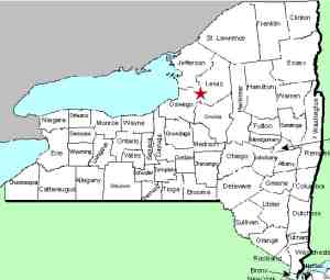
From the hamlet of Redfield in the northeast corner of
Oswego County, take CR17 north. In about two miles,
Otto Mills Drive will exit right. Take this for about
1.7 miles where it will end at the river.
|
| County: |
Oswego |
| Town: |
Redfield |
| USGS Map: |
Redfield |
| Waterway: |
Mad River North Branch |
| Latitude: |
N 43° 35' 36" |
| Longitude: |
W 75° 49' 5" |
| Drop: |
NA |
| Width: |
NA |
| Region: |
Northeast Oswego County |
| Parking: |
Dirt road |
| Trail type: |
Dirt and riverbank |
| Length of hike: |
0.4 mile |
| Difficulty: |
Moderate |
| Accessibility: |
Private |
| Name: |
Official |
|
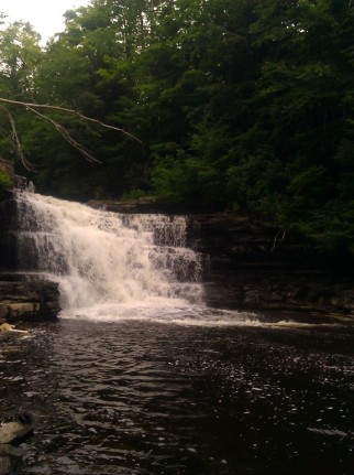
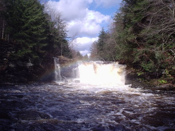
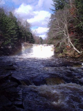
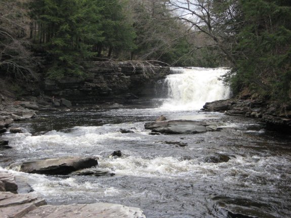
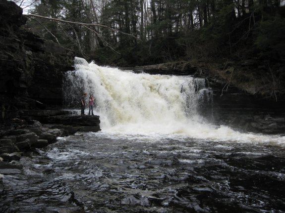
The Otto Mills Drive is a seasonally maintained
dirt road off Oswego County Route 17, in the area of the Battle
Hill State Forest. Actually, the road descends to the river,
but it looked more like an ATV trail so we opted to park and walk. There is a road heading downstream from the Otto Mills Drive,
but many sections are labeled as private property. It is known
that this section is a DEC fishing access site so the riverbank
is accessible. Please be aware that there are actually three
waterfalls on this stretch of the river. This is the furthest
downstream of the three and is the only one that is officially named.
It is about 0.4 miles from Otto Mills Drive.
The Mad River dumps into the Salmon River, which flows into Lake
Ontario.
Last update: November 14, 2015
|