| Directions
Travel NY 12 to Lyons Falls. Find the bridge crossing
the Black River and continue on the Lyonsdale Road.
About a mile before the Agers Falls Public Recreation Area,
you will find a parking lot on your left with signage indicating
the "Moose River Hiking Trail". Park here.
|
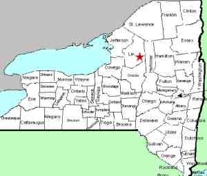
| County: |
Lewis |
| Town: |
Lyonsdale |
| USGS Map: |
Port Leyden |
| Waterway: |
Moose River |
| Latitude: |
N 43° 37' 9" |
| Longitude: |
W 75° 19' 21" |
| Drop: |
25' |
| Type: |
Curtain cascade |
| Region: |
East of Lyons Falls |
| Parking: |
Unpaved lot |
| Trail type: |
Dirt/rock |
| Length of hike: |
15 minutes |
| Difficulty: |
Easy |
| Accessibility: |
Public |
| Name: |
Common |
|
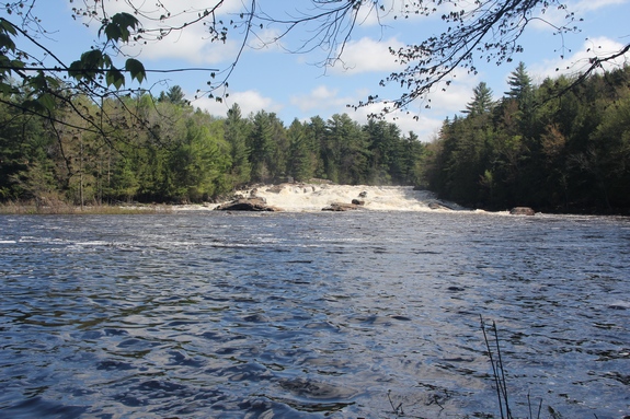
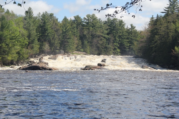
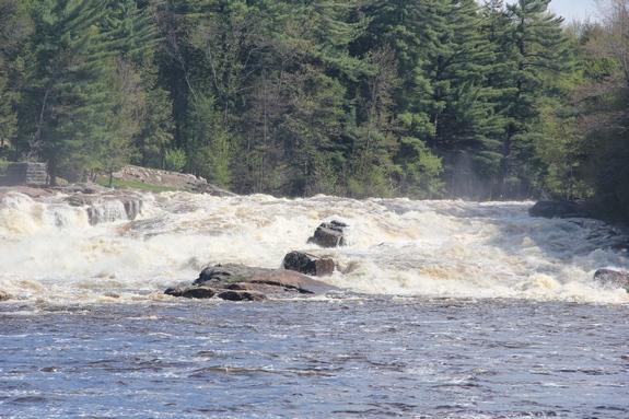
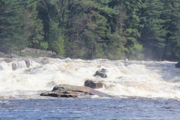
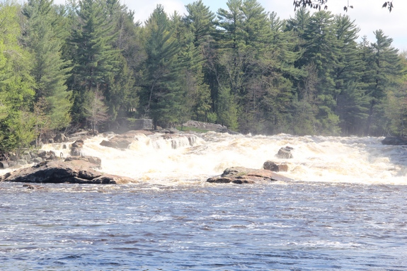
Follow the trail from here and when you reach the river, you
will be at a small waterfall/stretch of rapids known as Powerline.
Continue along the path upstream for another 1/4 mile or so and
you will come to a very nice waterfall that the whitewater community
has dubbed Shurform.
This is a large enough drop that we are somewhat surprised that
it doesn't have a name that pre-dates the whitewater kayaking era.
We will continue to look into that.
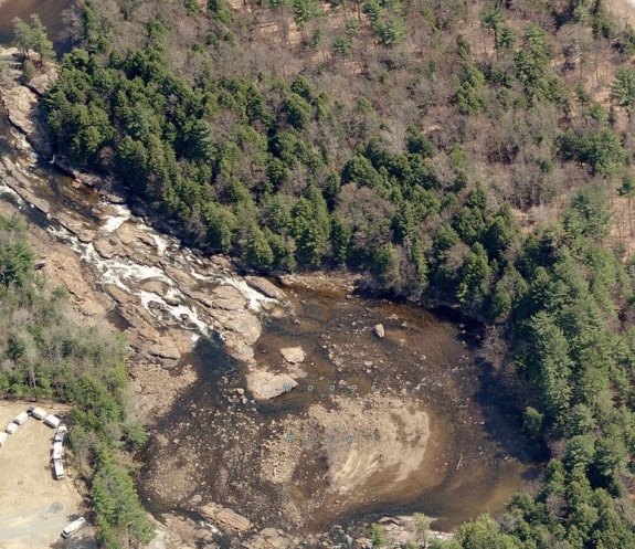
Water levels in this area can greatly affect the appearance of
the river. We have provided the last image in the array, from
Bing Maps, to show the dramatic difference in the way Shurform can
look. our photos show a very nice waterfall during heavy spring
run-off. The Bing Maps image shows a very different picture!
The Moose River flows into the Black River just a few miles downstream
from this location in Lyons Falls. The Black empties into
Lake Ontario in the Jefferson County community of Dexter.
Last update: January 14, 2016
|