| Directions
About two miles south of the hamlet of Keene Valley, NY 73
crosses the Ausable River East Branch. Immediately
south of the bridge and on the east side of the highway,
there is a parking area.
|
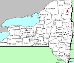
| County: |
Essex |
| Town: |
Keene |
| USGS Map: |
Keene Valley |
| Waterway: |
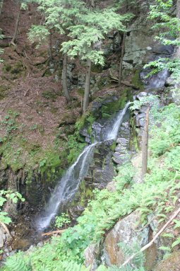
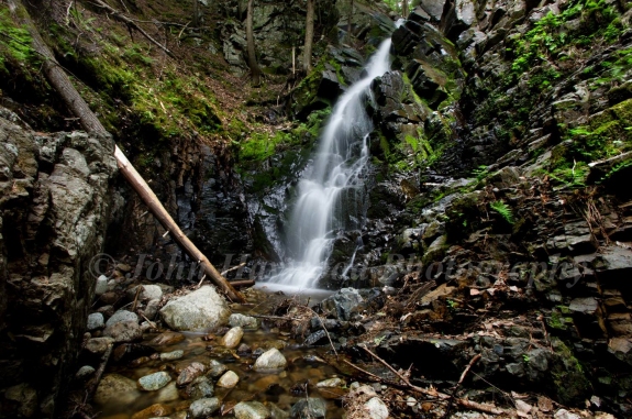
Mossy Cascade Brook |
| Latitude: |
N 44° 10' 00" |
| Longitude: |
W 73° 46' 19" |
| Drop: |
40' |
| Type: |
Ribbon Cascade |
| Region: |
Off NY 73 between Keene Valley and Saint
Huberts |
| Parking: |
Roadside |
| Trail type: |
Dirt |
| Length of hike: |
0.8 mile one-way |
| Difficulty: |
Moderate |
| Accessibility: |
Public |
| Name: |
Common |
|
 At the parking area, there is a sign indicating
the way to "Giant and Hopkins via Mossy Cascade." The trail
is clearly marked ... just follow the red trail markers on the
trees. At the parking area, there is a sign indicating
the way to "Giant and Hopkins via Mossy Cascade." The trail
is clearly marked ... just follow the red trail markers on the
trees.
Your hike starts with a short stint
parallel to the highway. Then it veers right and follows
the Ausable for a short distance. You will soon find
yourself turning toward the right and moving away from the
river. Not much further and you will encounter a structure on the left
with a truck road leading away from it. Just past this,
the trail will exit the road to the left. At roughly 0.6
miles into your walk, you will approach the Mossy Cascade Brook.
The easiest path we found to the waterfall's base was to
enter the brook bed at the point where it makes a 90 degree
bend. You will actually find some stone stairs leading
down ... about six steps or so. We want to stress that our
hike was done in June 2021. It had been a very dry summer
and there was not a lot of water in the stream. There is a
chance that under normal conditions, this path might be a bit
more of a challenge. At least it might be wetter! We
were able to find a fairly easy path, with a few rock hops, to
get to the bottom of the falls.
The alternative is to
continue up the trail with the brook on your left. Keep
looking to your left and you will see the crest of the falls
come into view. This point is probably just short of 3/4
mile from the parking area. Just downstream of this point,
it is possible to scramble down the embankment to reach the
stream bed. Again, some clarification is necessary.
I did this just two month's short of my 70th birthday.
Rather than a scramble, it was more of a controlled, gentle
slide. Since I had left my ropes in the truck, I opted to
return via the brook bed. That is how I found the
aforementioned stone steps!
A younger, more agile person
could have probably made the return up the embankment but a rope
tied off to the trees above would certainly have facilitated
this climb.
When you do get to the base of the falls, be
aware that there are a lot of downed trees which make
manuevering difficult. This is fairly recent because
pictures we were sent just a few years ago do not show these.
If you do follow the trail above the
waterfall, you will find a series of cascades for the next
quarter of a mile or so.Some refer to this as the Mossy Cascade Brook Falls.
Mossy Cascade Brook enters the Ausable River East Branch just
south of the hamlet of Keene Valley. This then joins forces
with the west branch in Ausable Forks. The combined Ausable
River empties into Lake Champlain in the town of Peru.
Last update: July 9, 2021
|