| Directions
On NY 812, about mid-way between the
hamlet of Old De Kalb and the village of Heuvelton,
the highway crosses the Oswegatchie River once.
Access to the river can be made in two different locations,
both just south of the bridge. There is parking
off CR 16 on the upstream side of the bridge or off
NY 812 just downstream of the bridge. From this
point, canoe or kayak upstream for about 1.6 mile to
this waterfall.
|
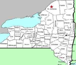
| County: |
St. Lawrence |
| Town: |
De Kalb |
| USGS Map: |
Rensselaer
Falls |
| Waterway: |
Oswegatchie
River |
| Latitude: |
N 44°
31' 10" |
| Longitude: |
W 75°
20' 29" |
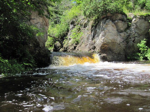
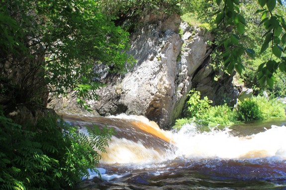
| Drop: |
4' |
| Type: |
Slide |
| Region: |
Southeast
of Canton |
| Parking: |
Unpaved |
| Trail type: |
Water route |
| Length of
hike: |
1.6 miles |
| Difficulty: |
Easy |
| Accessibility: |
Public |
| Name: |
Official |
|
Although not officially
named, Coopers Falls has been commonly known for many years.
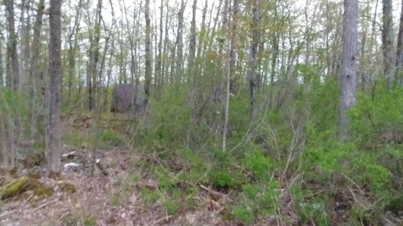
Maps indicate a community in this area and probably at one time,
there was a settlement there and perhaps a mill of some type.
Today, however, it is no longer a village or for that matter, even
a hamlet. Unless you know the landowners in this area, this waterfall
is only accessible by water. The good news is that water access
is quite easy. The park where you can put in is a very popular
spot for locals to swim, jump into the water, picnic and begin canoe
and kayak outings. The water upstream from this point is a very
calm flat-water stretch. Both trips we made to this area had
two, four-year-olds along. It is a very gentle portion of
the river. In fact, including this drop, the Oswegatchie only
drops about ten feet over several miles through here. It is
deceiving because, another 40 or so miles upstream, this river provides
some of the best white-water kayaking in the region.
Although we didn't see a place where a power boat could be launched,
there obviously has to be at least one. While we were there,
a family went by in a Boston Whaler sporting a good sized outboard
motor. There were also two PWCs tied up at a property just
downstream of the falls, so this area is navigable.
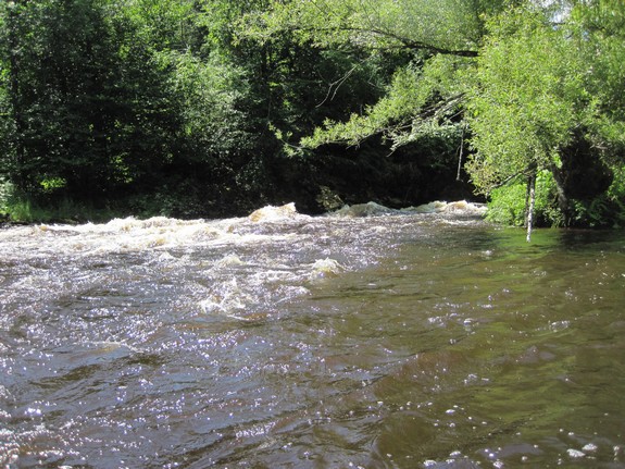
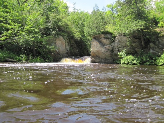
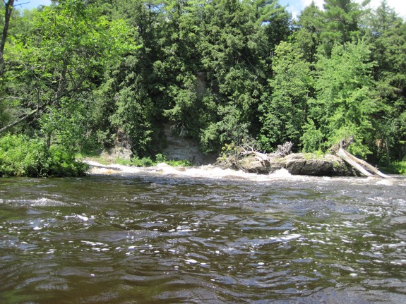
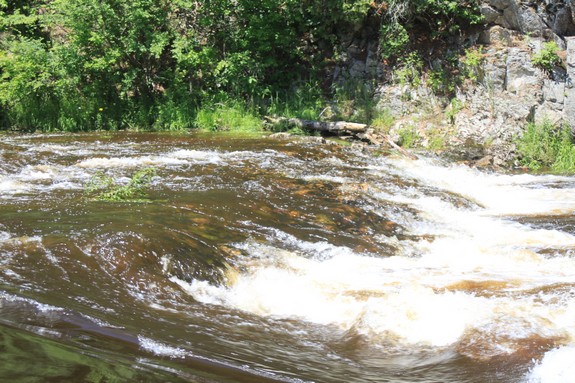
This location is a three-part waterfall, splitting around what
appear to be two islands in the channel known as Catfish Rock.
River left is a stretch of rapids that is a fairly straight shot
downstream passing the islands. River right is another set
of rapids that takes a 90 degree bend to the right above the islands.
The center channel takes another right angle bend and splits between
the two islands, rejoining the channel at a four foot cascade.
As a result of our Waterfall
Naming Project, Coopers Falls was added to the Geographic Names
Information System data base on April 19, 2019.
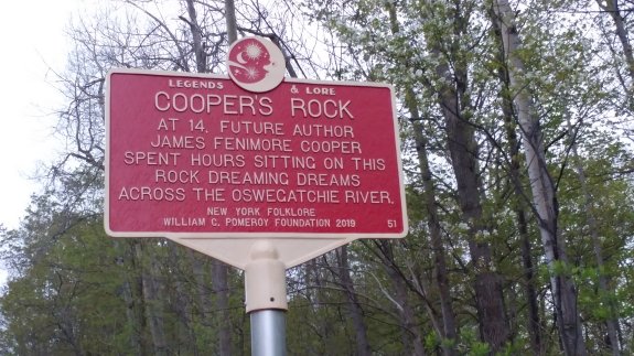
There is a recent addition near
this location. On NY 812 just inland from this waterfall,
a historical marker was placed sometime in 2019. This
marker notes Coopers Rock which is within site of the marker.
Local folklore has it that when the author James Fenimore Cooper
was young, his family vacationed in this area. He would
apparently gain inspiration perched on this rock. The
falls are named after him. On a side note, Cooperstown, in
the Catskill Mountain area of New York, is actually named after
Cooper's father.
The Oswegatchie River flows into the St. Lawrence River in
Ogdensburg, New York, less than 15 miles from this spot.
Last update: June 18, 2019
|