| Directions
On NY 58, a little over 1-1/4 miles
southeast of Gouverneur from the intersection of US
11 and NY 58, you will come to the Country Club Road,
where you should take a left. After the stop sign,
the road will "T" and a right will take you
over a bridge. 0.4 miles from this intersection
there will be another right. In another 3/4 mile
there is another right, the Emeryville Road. A
short distance up this road the falls will be visible
from a bridge on your left.
|
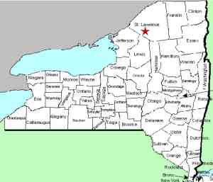
| County: |
St.
Lawrence |
| Town: |
Fowler |
| USGS
Map: |
Gouverneur |
| Waterway: |
Oswegatchie
River Island Branch |
| Latitude: |
N
44° 18' 51" |
| Longitude: |
W
75° 16' 16" |
| Drop: |
NA |
| Type: |
NA |
| Region: |
NY
58 between Gouverneur and Edwards |
| Parking: |
Roadside |
| Trail
type: |
Roadside |
| Length
of hike: |
Roadside |
| Difficulty: |
Easy |
| Accessibility: |
Private |
| Name: |
Unnamed |
|
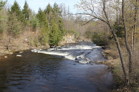
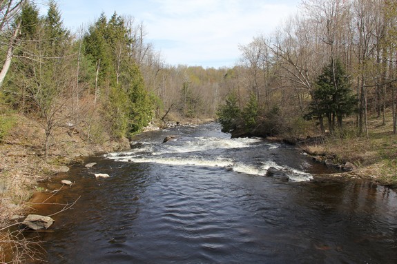
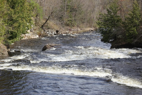
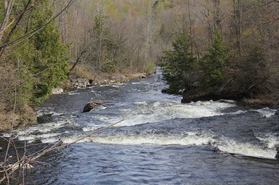
This is a very nice little
waterfall on a branch of the Oswegatchie River near the hamlet of
Hailesboro. Unfortunately, the only views of it are from over
the crest. Although the falls is just a short distance from
the bridge, you are looking downstream over it and the property
in this area is all private. The river here goes over a small drop of maybe a foot that is
angled across the channel. From the point where that ledge
meets the land on river left, there is another ledge that is about
a three foot drop that runs perpendicular across the width of the
river. After another few feet, the river drops over a steep
cascade split by a big rock that is part-way across the flow.
This final plunge is estimated to be 15 feet.
It is unfortunate that downriver views of this site aren't possible
because it is a very nice little waterfall. Even if access
were allowed by the property owners, good views might still not
be possible. The land on the right side of the channel looks
like it is physically able to be traversed, but the resulting vantage
point might not allow viewing. The river makes a sharp right
just after the base of the falls and the falls might be obscured
from that side. The best point would be the land on the left
side below the falls where the bend is formed. That side of
the river, however, is a fairly steep wall, so bank access might
still not be possible although the top of the gorge might be do-able.
Even river access is in question because there is a long stretch
of rapids below the falls. It would probably be a challenge
to make it upriver through that section in a canoe or kayak.
The Oswegatchie River flows into the St. Lawrence River in Ogdensburg,
New York.
Last update: June 7, 2016
|