| Directions
Take the Belfort Road from the village
of Croghan to the hamlet of Belfort. Then follow the
Long Pond Road and turn left when you come to the Bisha
Road. A short distance up this road, you will come
to a "Y". Bear left here onto the Kilbourn
Road. In a little over one-half mile, you will pass
the intersection of the Carthage Reservoir Road. A
little over one-half mile past this point, you will take
a left. In 0.1 mile take a right. Just keep
following the Public Fishing Access signs. You will
come to an angler's parking lot.
|
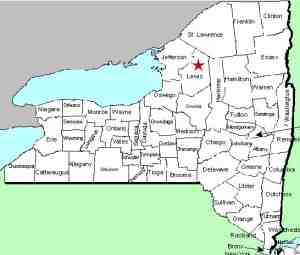
| County: |
Lewis |
| Town: |
Croghan |
| USGS
Map: |
Belfort |
| Waterway: |
Oswegatchie
River West Branch |
| Latitude: |
N
43° 59' 18" |
| Longitude: |
W
75° 17' 33" |
| Drop: |
~35' |
| Type: |
Slide |
| Region: |
Northeast
of Croghan |
| Parking: |
Unpaved
lot |
| Trail
type: |
Dirt |
| Length
of hike: |
0.4
mile |
| Difficulty: |
Easy |
| Accessibility: |
Public |
| Name: |
Common |
|
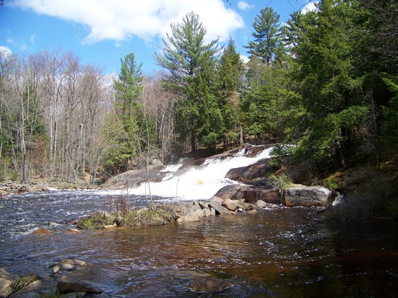
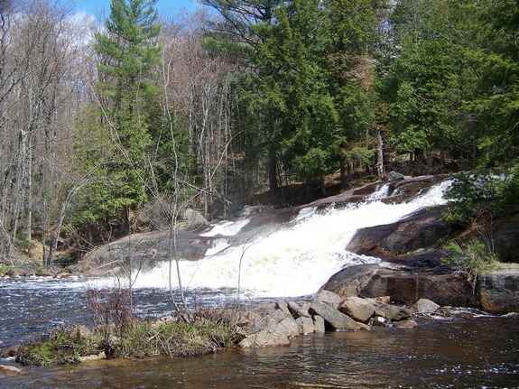
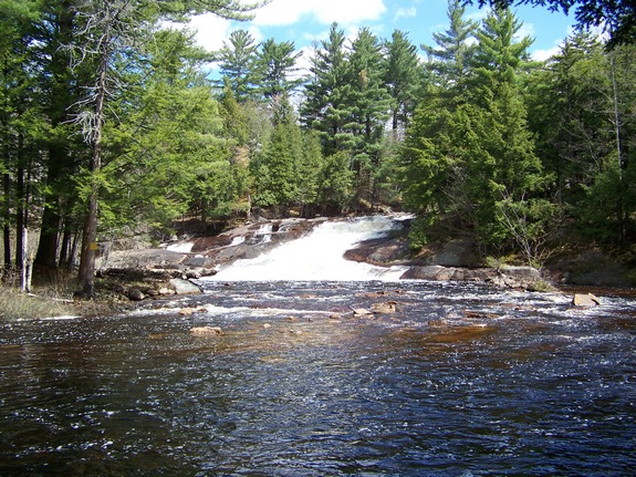
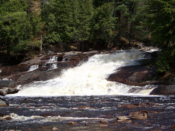
To find Kilbourn Falls, you will be on some unpaved roads.
Depending upon the time of year you make the trip, you might want
to be either in a truck or at least an SUV with adequate clearance.
Once at the angler's parking lot, the walk to the trail is about
0.4 of a mile. The trail is fairly well marked but make some
mental notes when you reach the river. The trail at that end
isn't quite as clear. It is easy to get turned around and
you want to make sure you know where you want to be to get out!
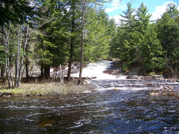
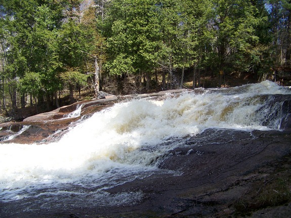
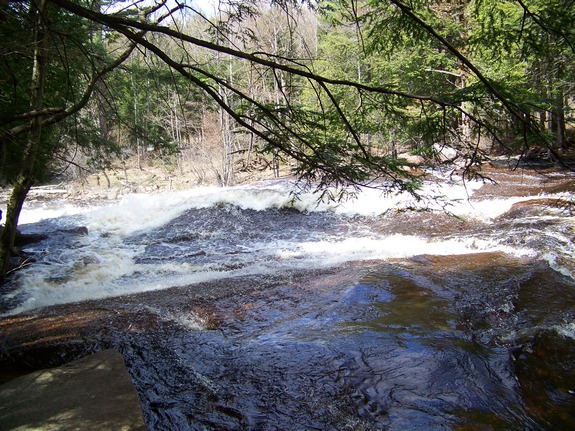
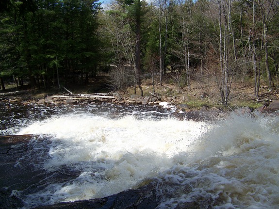
You can get some very nice views and pictures of the bottom of
the falls if you bear left and head downstream when you reach the
river. Then you will want to head upstream where you can literally
walk right up to the falls. Above the falls, the river is
actually quite calm. Anyone coming downstream in a canoe or
kayak better know what they are heading into! The serene and
quiet of the forest area could lull you into a sense of security.
Suddenly, a rock outcropping causes the channel to narrow to about
three feet and the water plunges an estimated ten feet. Then
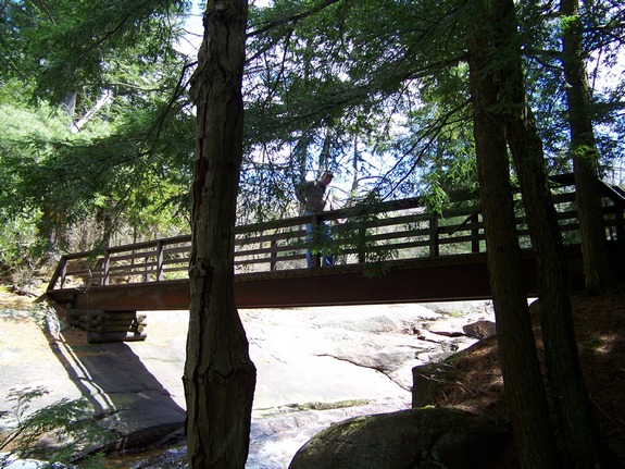
you have whitewater for a stretch as the river descends slightly
under a bridge before the waterfall takes its main plunge of 35
or so feet.
Although there are no picnic tables or other facilities here,
this would be a very nice destination for a family picnic.
You can relax and enjoy the solitude before making your hike out.
You might even want to bring your fishing gear. This is a
fairly popular site for anglers.
The West Branch of the Oswegatchie joins the main channel a few
miles downstream, just west of the hamlet of Talcville in the town
of Edwards. This then flows to the St. Lawrence River in Ogdensburg.
Last update: June 7, 2016
|