| Directions
Just west of Gouverneur on NY 58, there is a hamlet named
Natural Dam.
|
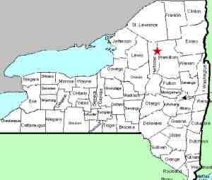
| County: |
St. Lawrence |
| Town: |
Gouverneur |
| USGS Map: |
Natural Dam |
| Waterway: |
Oswegatchie River |
| Latitude: |
N 44° 20'
03.38" |
| Longitude: |
W 75° 30'
15.50" |
| Drop: |
NA |
| Type: |
Dam |
| Region: |
East of Gouverneur |
| Parking: |
NA |
| Trail type: |
NA |
| Length of hike: |
NA |
| Difficulty: |
NA |
| Accessibility: |
Private - Mill |
| Name: |
Common |
|
We would like to extend our
thanks to Joe Laurenza, long-time Gouverneur area resident and educator,
who is now Curator of the Gouverneur Museum. Conversations
with him have confirmed that there was indeed, once a waterfall
at this location.
He has provided us with the following
account. In 1805 when the first settlers came here the thought
was to have the original settlement at Natural Dam, probably because
of the natural dam and falls there. Gouverneur Morris had his home
built there for that reason. He never lived here, only visited two
or three times. His land agents lived in the house. The early settlers
decided that the settlement should be where the present village
is and moved. A sawmill and flour mill were erected in Natural Dam
in 1808, and there has been some type of mill there for over 200
years. His house still stands in very poor condition and is abandoned
at this time I believe. We have no early photos of Natural Dam except
of the house.
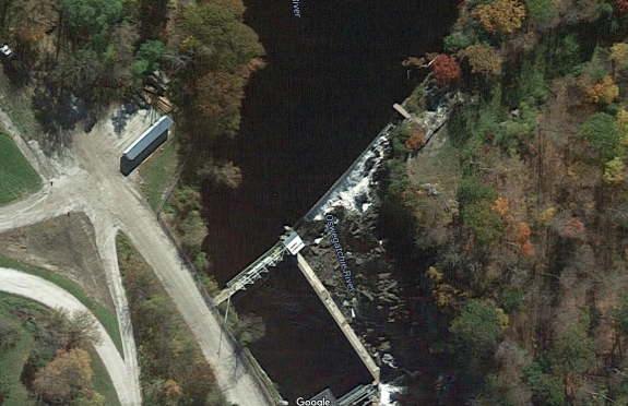
There is still a waterfall below the dam. Property on
the south side of the river is private so it appears that the
only way to actually see the waterfall is to access it through
the mill property. We are working on that possibility.
If anyone has any information or pictures of this area, please
contact us.
The Oswegatchie River flows to the St. Lawrence River in Ogdensburg.
Last update: June 7, 2016
|