| Directions
This location is within the hamlet of
Edwards.
|
|
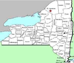
County: |
St. Lawrence |
|
Town: |
Edwards |
|
USGS Map: |
Edwards |
|
Waterway: |
Oswegatchie River |
|
Latitude: |
N 44° 19' 18" |
|
Longitude: |
W 75° 15' 20" |
|
Drop: |
NA |
|
Type: |
Historical |
|
Region: |
Off NY 58 within the hamlet of Edwards |
|
Parking: |
NA |
|
Trail type: |
NA |
|
Length of hike: |
NA |
|
Difficulty: |
NA |
|
Accessibility: |
NA |
|
Name: |
Common |
|
Tannery Falls
is another of the many waterfalls in Northern New York that no longer
exists. Most of the falls that fall into that category do
so because a hydro-electric dam has been built at the location and
the waterfall was either covered with water or dried up. In
the case of Tannery Falls, something else happened.
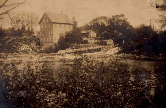
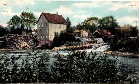
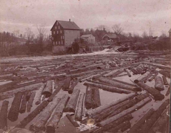
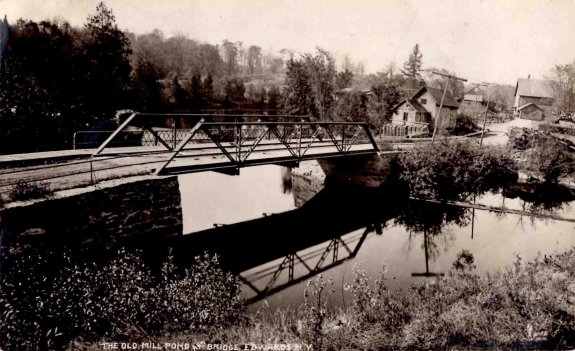
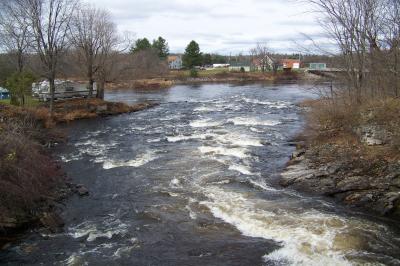
Within this community, there is an island in the Oswegatchie
River. Back in the 1800s and early 1900s, the road through
here was the main highway through town. Under the channel
around the east side of the island, there was a bridge spanning
a mill pond. on the other side of the island, another
bridge crossed the west channel over Tannery Falls, a waterfall
of an estimated 12 to 15 feet in height. This island once
was a hub of activity in this community. A grist mill and
saw mill operated here. Some of our pictures show a flume
which carried logs being transported downstream around the waterfall.
Around 1910, an electric production plant was built here.
A local businessman constructed the plant which supplied electric
power to the village and surrounding area.
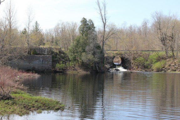
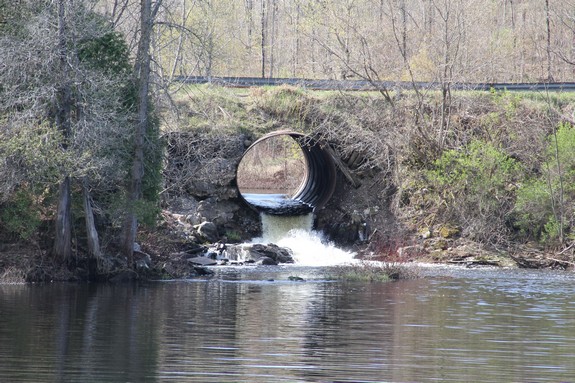
As technology changed and the industry here ceased, the area
of the west bridge was filled in and a sluice pipe channeled the
water under the highway. That has been replaced a few times
over the years as it has rusted out and today, all that is left
of Tannery Falls is this sluice pipe. Due to its slant as
it goes under the road, the outlet only drops about four feet into
the pool below. Two of the pictures in the array show what
this area looks like today.
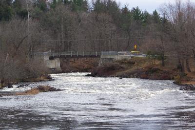
At some point, a new road and bridge were built another location
just downstream from the island. This new road became the
main road through time and over time, traffic ceased over the island.
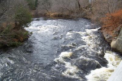
In the late 1990s, the bridge over the east channel was removed
and replaced with a pedestrian bridge. Under it is a pretty
little set of rapids. The road is now a dead-end.
Even the village where this was located no longer exists!
Once the village of Edwards, the residents here voted to dissolve
the village and become part of the township of Edwards. That
vote took place in 2011 with an effective date of January 1, 2013.
The Oswegatchie River flows into the St. Lawrence River in
Ogdensburg, New York.
Last update: June 9, 2016
|