| Directions
Take NY 12 into the hamlet of Glenfield,
Glenfield Road from the north or Main Street from the
south. These come together as you enter the hamlet.
Take a right onto the Greig Road. A short distance
from the hamlet, your second left will be the Odett
Road. Take a left at the "T" where this
road ends. Your first right will be the Eatonville
Road. Follow this seasonally maintained dirt road.
Bear left where the Van Arnam Road exits and you will
come to a bridge crossing the Otter Creek. Park
and look upstream.
|
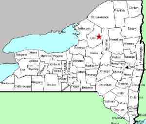
| County: |
Lewis |
| Town: |
Greig |
| USGS
Map: |
Brantingham |
| Waterway: |
Otter
Creek |
| Latitude: |
N
43° 42' 52" |
| Longitude: |
W
75° 20' 36" |
| Drop: |
~20' |
| Type: |
Multiple drops |
| Region: |
East of the hamlet of Glenfield |
| Parking: |
Unpaved
area |
| Trail
type: |
Dirt,
stone |
| Length
of hike: |
NA |
| Difficulty: |
Easy |
| Accessibility: |
Public |
| Name: |
Official |
|
 Although not noted on
USGS topographical maps, Eatonville Falls is promoted in a number
of brochures and websites about this area. From the parking
area, you will see the falls about a tenth of a mile upstream. Although not noted on
USGS topographical maps, Eatonville Falls is promoted in a number
of brochures and websites about this area. From the parking
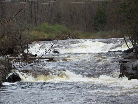
area, you will see the falls about a tenth of a mile upstream. This waterfall
contains three sections. You can
get a very nice view of the upper portion, a two-step tiered
drop, by walking up the riverbed from the parking lot side of
the river.
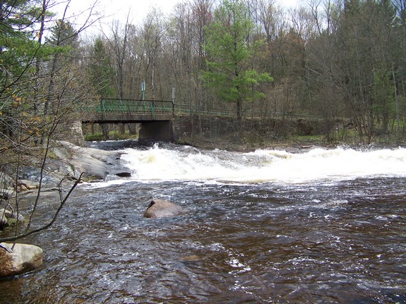
The middle portion of about 10 feet right under the
bridge you just drove over. You can get a good view of this
slide from the bridge or from downstream on the shore, also on
the parking lot side.
Walk a bit further downstream and you can see the lower section. This lower portion
is a
slide/rapids.
Our two videos are of the upper and middle sections,
respectively.
There is a small campground/picnic area here. In addition
to the campground, this stretch of river is very popular with kayakers
and the fishing community.
The name of this waterfall is now official, having been added
to the GNIS data base on November 9, 2017.
The Otter Creek flows into the Black River just downstream from
the village of Glenfield. The Black River joins Lake Ontario
just west of Watertown in Dexter, New York.
Last update: November 14, 2017
|