| Directions
From the intersection of NY 3 and NY 58 in Fine,
drive up 58 into the hamlet. Take a right on CR 27
and then a left on the Folsom Road. At about 2.3
miles up this road, this waterfall will be on the left.
|
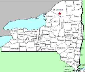
| County: |
St. Lawrence |
| Town: |
Fine |
| USGS Map: |
South Edwards |
| Waterway: |
Paddy Brown Brook |
| Latitude: |
N 44°
16' 30" |
| Longitude: |
W 75° 08' 50" |
| Drop: |
2' |
| Type: |
Curtain
cascade ... very small |
| Region: |
Southeast of Edwards |
| Parking: |
Roadside |
| Trail type: |
Dirt |
| Length of hike: |
NA |
| Difficulty: |
NA |
| Accessibility: |
Unknown |
| Name: |
Common |
|
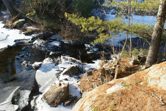
We have recently obtained some pictures of this location but are
still researching it. This is an extremely small drop but
ironically is listed on topographical maps as "Falls". The
name is based on the brook that it is on and has been known as
such for quite some time.
If anyone
has any information or pictures of this waterfall, please
contact us.
The water from the Paddy Brown Brook flows into the Stammer
Creek, which joins the Oswegatchie River just southeast of the
village of Edwards. The Oswegatchie River flows into the
St. Lawrence River in Ogdensburg
Last update: January 18, 2017
|