| Directions
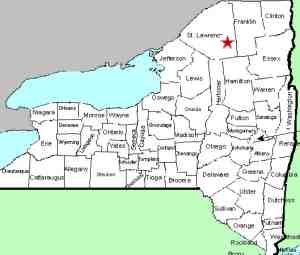
This waterfall is located off the east
side of NY 56, 1.5 miles from its intersection with NY 3
at Sevey Corners. As you approach, you will see a
tree stump at the top of the bank on your right with small
DEC signs.
|
| County: |
St. Lawrence |
| Town: |
Colton |
| USGS Map: |
Childwold |
| Waterway: |
Raquette River |
| Latitude: |
N 44° 18'
42" |
| Longitude: |
W 74°
42' 56" |
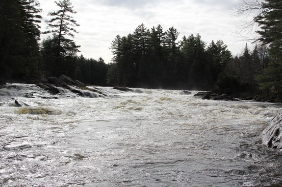
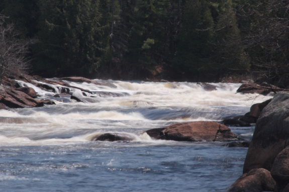
| Drop: |
20' |
| Type: |
Rectangular
Cascade |
| Region: |
NY 56 between
Tupper Lake and Colton |
| Parking: |
Roadside shoulder |
| Trail type: |
Dirt |
| Length of hike: |
5 minutes |
| Difficulty: |
Easy |
| Accessibility: |
Public/state land |
| Name: |
Official |
|
 There
is no parking lot per se at this location. You will need to
park on the shoulder of the road. There is moderate traffic
here and it does come by at speed, so use caution. The signs
on the tree stump read "NYS Environmental Conservation Canoe
Carry". Climb the embankment and you will find a fairly
well-worn and marked trail. There
is no parking lot per se at this location. You will need to
park on the shoulder of the road. There is moderate traffic
here and it does come by at speed, so use caution. The signs
on the tree stump read "NYS Environmental Conservation Canoe
Carry". Climb the embankment and you will find a fairly
well-worn and marked trail.
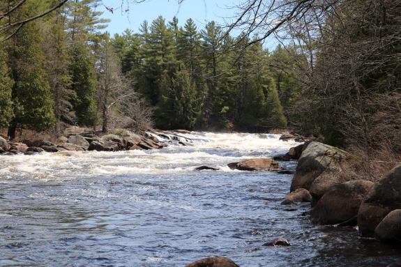
The river bank is 0.1 mile
from the highway. Once you reach the river, you
need to hike another 0.1 mile upstream and get closer to the
base of the falls. When we first visited here several
years ago, the trail along the river was fairly well defined.
For the past few years, tree limbs and large branches
now litter one section so you will have to step over that.
These obstacles, probably deposited there by spring run-off, now
create a bit of a chore to traverse this stretch.
We
contacted DEC in June 2017 to find out if any cleaning was
planned. We were told that they "generally don't clean up
natural debris along the shore of a river or lake unless it is
in a developed, Intensive Use Area." This trail is not
considered in that category.
Depending upon the
water lever when you attempt this walk, you may need waterproof
footwear or, at least, prepare to get wet. Once you get
past this 100 foot or so stretch, you will come to the end of
DEC land. In the past, beyond here is private and posted.
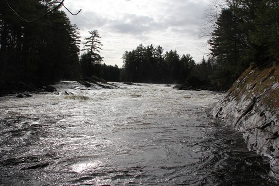
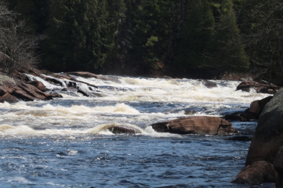
After the main drop,
the river takes about a 90o bend and forms a "U".
There are some rapids in this stretch, including a drop of 2 or
3 feet over a ledge.
Due to the lack of road markings at the trailhead, we thought
it wise to mark the waypoint of the access point on the road.
The coordinates we marked on the shoulder where we parked were N
44.31259 and W 74.72020.
The Raquette River empties into the St. Lawrence River in Massena,
New York
Last update: July 1, 2017
|