| Directions
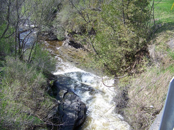
From NY 26 in Martinsburg, head west
on Cemetery Road. Just past the first intersection,
you will cross a bridge. The falls are under this
bridge.
|
| County: |
Lewis |
| Town: |
Martinsburg |
| USGS
Map: |
Glenfield |
| Waterway: |
Roaring
Brook |
| Latitude: |
N
43° 44' 07" |
| Longitude: |
W
75° 28' 21" |
| Drop: |
~15' |
| Type: |
Step |
| Region: |
In
the hamlet of Martinsburg |
| Parking: |
Roadside |
| Trail
type: |
Dirt |
| Length
of hike: |
5
minutes |
| Difficulty: |
Easy |
| Accessibility: |
Public |
| Name: |
Common |
|
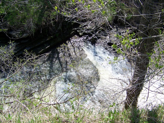
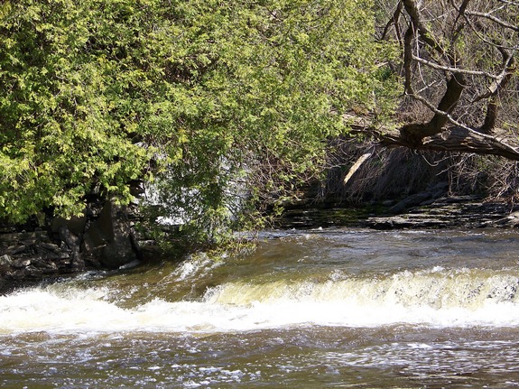
Technically unnamed, these
falls are located in the hamlet of Martinsburg and are commonly
referred to as Martinsburg Falls. The brook at this point
narrows through a channel and plunges about 15 feet. A few
more feet downstream, it drops another 2 or 3 feet before leveling
out. You can look down on these falls from the bridge. You
can also get a good view of them from the west bank. You are
at the top of a small gorge at this point. Take a short walk
along the west bank and you can make your way down to the riverbank.
Unfortunately, you don't really have a good view from here.
You can see the falls, but the trees and foliage block your sight.
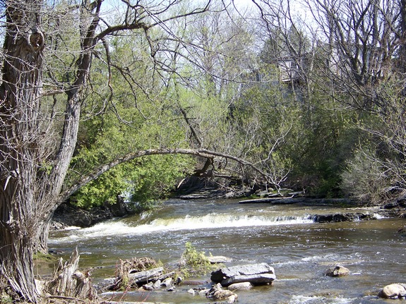
The best views are probably from the east side of the waterway,
but there are houses through this stretch and, as such, it is all
private property. We found that although you can get a decent
view of this waterfall, you really can't get that good of a picture
of it from downstream.
Martinsburg was named in honor of its founding father, Walter
Martin. originally spelled Martinsburgh, it was actually the
Lewis County seat until 1864. According to the Widipedia account,
Martinsburg was the site of the first county court session and the
site of the only execution ever held in the county. This stretch
of water is quite popular with the whitewater community.
The Roaring Brook flows into the Black River just downstream
from the Whetstone Gulf area. The Black River joins Lake ontario
just west of Watertown in Dexter, New York.
Last update: August 25, 2016
|