| Directions
3.0 miles east of where these Routes
30 and 8 come together in Speculator, turn on Old Route 30.
From the south, this intersection is about
6.5 miles from the Routes 30 and 8 intersection in Wells.
This is a seasonal road not maintained in
the winter. At 0.1 miles down this road, you
will cross a bridge. At 2.0 miles, there is a
second bridge, a one-lane relic. Park on the
roadside at the 2.7 mile point.
|
| County: |
Hamilton |
| Town: |
Wells |
| USGS Map: |
Page Mountain |
| Waterway: |
Sacandaga River |
| Latitude: |
N 43°
30' 05" |
| Longitude: |
W 74°
16' 46" |
| Drop: |
40' |
| Type: |
Step |
| Region: |
Off
NY 30 between Speculator and Wells |
| Parking: |
Roadside |
| Trail
type: |
Dirt |
| Length
of hike: |
0.1
mile/2 minutes |
| Difficulty: |
Easy |
| Accessibility: |
Public |
| Name: |
Official |
|
 Austin Falls is located
on a stretch of NYS Routes 30 and 8 that run together from Speculator
to just north of Wells. The directions in the side-bar
will result in the shortest hike to get to the falls, but they
do warrant a comment. This road is paved, but don't read
too much into that. The pavement is cracked and heaved.
Just about the time you feel comfortable doing about 30 MPH,
you'll come to a bump where you wish you had been going 10! Austin Falls is located
on a stretch of NYS Routes 30 and 8 that run together from Speculator
to just north of Wells. The directions in the side-bar
will result in the shortest hike to get to the falls, but they
do warrant a comment. This road is paved, but don't read
too much into that. The pavement is cracked and heaved.
Just about the time you feel comfortable doing about 30 MPH,
you'll come to a bump where you wish you had been going 10!
We have read, either in books or on-line, that there are two other alternatives to
get to these falls. Having said that, we have not used
those routes. The first of these options is from the other end of this
Old Route
30. From the main highway, you will pass a road where an abandoned
bridge is visible. The is a barricade across the ends of
it. Assuming you can walk over the bridge,
the falls are 0.8 miles down the road. The second option
is to drive 0.8 miles north on the main highway and walk through
the woods to the falls from that side of the river. As we
stated before, these two methods were not tried.
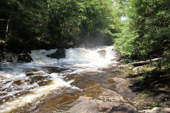
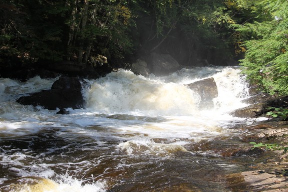
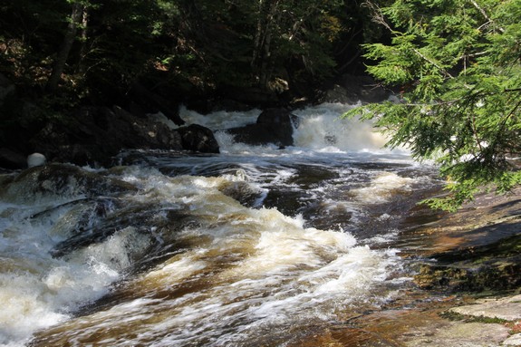
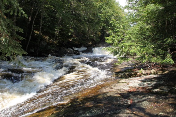
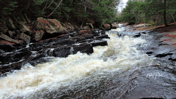
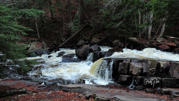
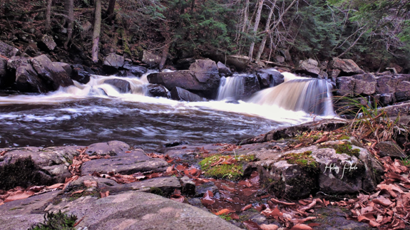
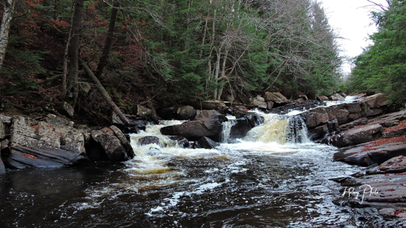
Austin Falls is a multi-step drop that covers about 300 yards
of the river. It appears to be a continuous waterslide but
at the top are some boulders. The water pouring through here
gives the illusion of a plunge at that point due to the splashing
off the rocks.
The Sacandaga River flows through a number of lakes as it makes
its way to the Hudson River whose final destination is the Atlantic
Ocean.
Last update: August 26, 2017
|