| Directions
It appears that this area is only accessible by
permission of the landowners or by canoe/kayak on the
river.
|
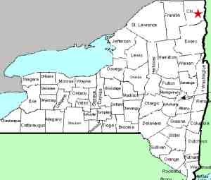
| County: |
Clinton |
| Town: |
Plattsburgh/Schuyler
Falls |
| USGS Map: |
Morrisonville |
| Waterway: |
Saranac River |
| Latitude: |
N 44° 42'
13" |
| Longitude: |
W 73°
36' 06" |
| Drop: |
NA |
| Type: |
Slide/ribbon
cascade |
| Region: |
West of Plattsburgh |
| Parking: |
NA |
| Trail type: |
NA |
| Length of
hike: |
NA |
| Difficulty: |
NA |
| Accessibility: |
Private |
| Name: |
Official |
|
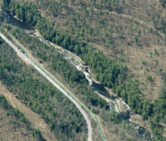
The Kent Falls Road runs roughly between the hamlets of Cadyville
and Morrisonville. The bridge where the road crosses the Saranac
River has been taken out of service. Although still physically
there, vehicular traffic is not allowed on it. Essentially,
this road is now two, dead-end roads. These roads can be
accessed from the hamlet of Cadyville off Goddeau Street on the
west and just off the West Main Street/Sand Road intersection in
Morrisonville from the east.
At the bridge on the Cadyville side of the road, there is a
small parking area. From there on the downstream side, you
can see the top of a dam. This is the Kent Falls dam.
Below this dam, there is a long slide type waterfall with a
ribbon cascade type plunge at the bottom of it.
Kent Falls is an officially name waterfall, listed on the
USGS GNIS. As such, the latitude and longitude of its
location are established. Those coordinates listed at the
left are the same as those listed on the federal data base and
they fall mid-way through this slide.
We have posted a satellite image of this area from Bing Maps.
If anyone has any additional information on
this location, please
contact us.
The Saranac River empties into Lake Champlain just downstream
in the city of Plattsburgh.
Last update: May 9, 2016
|