| Directions
From I-87, exit 36, go south on 22 a very short
distance and take CR 32 to the right. Follow this
to the intersection of Military Turnpike and take a
right.
|
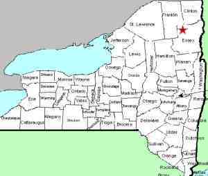
| County: |
Clinton |
| Town: |
Plattsburgh |
| USGS Map: |
Morrisonville |
| Waterway: |
Saranac River |
| Latitude: |
N 44° 40' 12" |
| Longitude: |
W 73° 30'
21" |
| Drop: |
NA |
| Type: |
Step cascade |
| Region: |
West
of the city of Plattsburgh |
| Parking: |
Roadside |
| Trail type: |
Dirt |
| Length of hike: |
Very short |
| Difficulty: |
Easy |
| Accessibility: |
Apparently
accessible |
| Name: |
Unnamed |
|
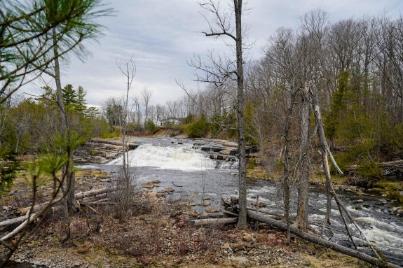
When you get to the Saranac River, there is a hydro facility on
the right. As the river goes under the bridge, there is a
small island behind this plant. This waterfall is at the
point where the two channels converge behind the island. Details on parking and where to see this drop will be posted
soon.
Please note that we have listed this as being in the town of
Plattsburgh. Technically, the Saranac River is the town
line between Plattsburgh and Schuyler Falls. However,
since this waterfall is located on the north side of the river,
completely within the town of Plattsburgh, we have listed it
that way.
Our thanks to Kelly Magnuson for sending in these photos and
information.
The Saranac River flows into Lake Champlain in Plattsburgh.
Last update: May 8, 2020
|